Willkommen bei MapFox
Wurde Ihre Bestellung bestätigt? Wenn nicht - gab es evtl. ein SERVER-Problem! Bitte kontaktieren Sie uns! +++ Buchhändler-Anfragen erwünscht +++
Warenkorb
Artikel: 0 - € 0.00
Zur Kasse
Widerruf Impressum Kontakt Versandkosten AGB
Walking on Uist and Barra Wanderführer Schottland - Cicerone Großbritannien (englisch)
<< Schottland
<< Cicerone
 
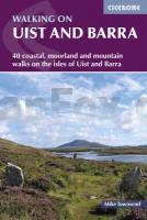
Cover

Located on the edge of north-west Europe, the islands that make up the southern end of the Outer Hebrides are places of staggering contrasts: rugged hills, shell sand beaches, awesome sea cliffs, caves and arches, moors and lochs. Although relatively accessible by air and by sea, much of the archipelago still remains unspoilt. Few who go there venture far from the roads.

The 40 graded day walks described in this guide take in the full range of terrain in this unique island group visiting Berneray, North Uist, Grimsay, Benbecula, South Uist, Eriskay, Barra, Vatersay and Mingulay.

This guidebook includes a selection of easy, coastal walks along beaches and cliffs but also some wilder and mountainous routes further inland, on Uist and Barra and on the offshore islands.

  • a variety of day walks across the islands from 3km to 17km
  • illustrated with OS map extracts and photographs
  • lots of information about wildlife, geology and history to accompany each route
  • Kartenausschnitt

    Kartenbeispiel

    Walking on Uist and Barra Wanderführer Schottland - Cicerone Großbritannien (englisch)
    EAN / ISBN: 9781786311443
    Preis: EUR 25.90

Bestellartikel: versandfertig in ca. 3-7 Tagen. Dieser Artikel wird speziell für Sie bestellt. Keine Rücknahme!
Produkt EUR Anzahl Bestellen
Walking on Uist and Barra Wanderführer Schottland - Cicerone Großbritannien (englisch) 25.90
Versandkostenfrei in Deutschland ab 30,- Bestellwert

incl. MwSt.

Stichworte, die bei der Suche nützlich sein könnten:
äußere Hebriden Wanderführer - Cicerone Wanderführer - Hebriden Wanderführer - Barra - Schottland - Großbritannien - äußere Hebriden - Großbritannien Wanderführer - Hebriden - Barra Wanderführer - Uist - Uist Wanderführer - Schottland Wanderführer - Cicerone - Cicerone - Cicerone Radwanderführer - Cicerone Wanderführer - Großbritannien Radwanderführer - Großbritannien Wanderführer - Cicerone Großbritannien - Schottland - Schottland Landkartenverkauf - Schottland Atlanten - Schottland Kartographie - Schottland Wanderkarten - Schottland Radwanderkarten - Schottland Kartografie - Schottland Fahrradkarten - Schottland Reiseführer - Schottland Radwanderführer - Schottlandkarten - Schottland Landkarten - Schottland Karten - Schottland Straßenkarten

Zuletzt angesehene Artikel:

CoverWalking on Uist and Barra Wanderführer Schottland - Cicerone Großbritannien (englisch)

CoverOh, dieses Österreichisch! Fremdsprech (Band 910) - Dippelreither Conrad-Stein-Verlag

CoverEigerwand - A Climber`s Guide to the 1938 Heckmair Route Kletterführer - Rick Kollath - Kollath Graphic Design

CoverSnowdonia National Park pocket map 1:120.000 Pocket map - National Parks UK and Collins Maps

CoverDUMONT Reise-Taschenbuch Ostfriesische Inseln & Nordseeküste von Banck, Claudia

Cover55 Oberstaufen - 1:35.000 Outdoorkarte - Wanderkarte Kümmerly & Frey

Noch kein Cover vorhanden7911 Breisach am Rhein Topographische Landkarte 1:25.000 - Landesvermessungsamt Baden-Württemberg

Cover6405 Freudenburg Topographische Karte 1:25.000 - Landesamt für Vermessung und Geobasisinformation Rheinland-Pfalz

CoverBohinj 1:25.000 - Triglav - Krn - Črna prst Bergwanderkarte GPS SIDARTA Slowenien

CoverR4141 Raahe Topographische Karte 1:25.000 EUREF (Peruskartta) Maanmittauslaitos / Lantmäteriverket Finnland - ProjektNord

Cover3024OT BEAUNE - CHAGNY Topographische Wanderkarte Frankreich 1:25.000 TOP 25 IGN - (GPS)

CoverTrekking the Slovene Mountain Trail Wanderführer
Slovenska planina pot Cicerone (englisch)

Cover562 Südlicher Bayerischer Wald - Passauer Land 1:50.000 Radwanderkarte Fritsch Landkarten-Verlag

CoverKolumbien Landkarte (Blatt 3405) AdventureMap wasserfest
Colombia National Geographic

Cover19/7-8 KAPELHOEK - HOOGSTADE NGI 1:25.000 Topographische Landkarte Belgien

Cover162 Greenwich & Gravesend - Wanderkarte Großbritannien 1:25.000 EXPLORER MAP - Ordnance Survey

Cover6: Nord-Schweden Nord: Lulea - Kiruna - Narvik 1:400.000 - Kümmerly & Frey