| << Kanalinseln << Großbritannien: Reiseführer << Großbritannien: Wanderführer + Kletterführer << Sunflower-Wanderführer |
  | |
Zuletzt angesehene Artikel:
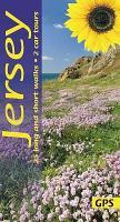
![]() | Jersey Sunflower-Wanderführer - englisch - kostenlose Updates - car tours & walks |
![]() | 0652 JARAICEJO Topographische Landkarte 1:50.000 Spanien (Grundlage MTN50) Instituto Geográfico Nacional - CNIG Spanien - ProjektNord |
![]() | Hansestadt Rostock - Stadtplan 1:20.000 (Nr. 191) Mit allen Stadtteilen, mit neuen Straßennamen, mit Postleitzahlen, mit Innenstadtkarte, mit Umgebungskarte, Maßstab 1: 20000 Dr. Barthel Verlag |
![]() | 0578 ARENAS DE SAN PEDRO Topographische Landkarte 1:50.000 Spanien (Grundlage MTN50) Instituto Geográfico Nacional - CNIG Spanien - ProjektNord |
![]() | Appennino Faentino foglio 6 - Wanderkarte 1:50.000 Italien (italienisch) - edicicloeditore |
![]() | 2152 Lebbin Topographische Karte 1:25.000 Messtischblatt des Deutschen Reiches - Preußische Landesaufnahme / Reichsamt für Landesaufnahme - Faksimile ProjektNord |
![]() | USA politisch Decorator - große Ausgabe PLANO-Karte 1:2.815 Mio. (Format: 176 x 122 cm) - gerollt im Plastikrohr USA political decorator enlarged flat map National Geographic |
![]() | Honolulu & Oahu (Hawaii) 1:18.000 / 1:80.000 - Landkarte - ITMB International Travel Reference Maps (engl.) Honolulu (Waikiki to Pearl Harbour) and Oahu |
![]() | Welt politisch - 3 Karten PLANO-Karte 1:15.267 Mio. (Format: 288 x 194 cm) - gerollt im Plastikrohr World political flat map 3-sheets National Geographic |
![]() | USA politisch Decorator - große Ausgabe Laminierte PLANO-Karte 1:2.815 Mio. (Format: 176 x 122 cm) - gerollt im Plastikrohr USA political decorator enlarged flat map - laminated National Geographic |
![]() | Amalfi-Küste: Wanderkarte Nr. 1 - 14 Wanderungen von Vietri sul Mare nach Minori 1:10.000 (engl.) Touristische Wanderkarte Italien Cart&guide Amalfi Coast: Map of the Paths n.1 - 14 intineraries from Vietri sul Mare to Minori Officine Zephiro - Italien |
![]() | Dreistadt - Touristische Radwanderkarte 1:26.000 Wanderkarte, Radwanderkarte, Freizeitkarte, laminiert Rowerowe Trójmiasto ExpressMap - Polen |
![]() | Entdecke die Antarktis Landkarte der Antarktischen Halbinsel - Karte des Antarktischen Kontinents (Antarctica) Nigel Sitwell - Ocean Explorer Map |
![]() | Welt Executive politisch Laminierte PLANO-Karte 1:36.38 Mio. (Format: 117 x 76 cm) - gerollt im Plastikrohr World political flat map executive - laminated National Geographic |
![]() | Baikalsee - Barguzin Bucht - Chivirkuy Bucht - Poluostrow Swjatoj Nos - 1:100.000 / 1:900.000 Touristische topographische Landkarte - Russland FGUP Vostočno sibirskoe aerogeodezičekoe predprijatie |
![]() | Estland Straßenatlas 1:175.000 Eesti - Estonia road atlas Jana Seta |
![]() | Bialystok 1:20.000 Laminierter Stadtplan Białystok ExpressMap Polen |
![]() | Alte Vie di Firenzuola 1:25.000 - Topographische Wanderkarte - Italien Carta escursionistica dell`Alta Via di Firenzuola (AVF100), 4 tappe lungo il periplo delle alture intorno alla conca di Firenzuola l´Escursionista Editore Italien |
![]() | Stettin - Pölitz Stadtplan 1:22.000 Laminierter Stadtplan Szczecin Police Świnoujście mapa foliowana ExpressMap - Polen |
![]() | Kuba West 1:600.000 Landkarte - ITMB International Travel Reference Maps (engl.) Cuba West - Havana, Varadero, Cienfuegos, Trinidad |


