 These are circular routes and family traffic-free cycling trails with clear, easy to follow maps. National Cycle Network Routes are shown as are well researched local routes to make the most of the beautiful scenery in the area. Cycle hire centres are highlighted as well as places to eat or grab a coffee. The maps are laminated for protection.  Kartenbeispiel Kartenbeispiel
|
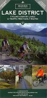
Lake District Fahrradkarte 1:100.000 Cycling maps - country lanes & byways (waterproof)
Lake District cycling map Goldeneye Publications - Großbritannien
EAN / ISBN: 9781859651841
Preis: EUR 12.90
|
|


