Willkommen bei MapFox
Wurde Ihre Bestellung bestätigt? Wenn nicht - gab es evtl. ein SERVER-Problem! Bitte kontaktieren Sie uns! +++ Buchhändler-Anfragen erwünscht +++
Warenkorb
Artikel: 0 - € 0.00
Zur Kasse
Impressum Kontakt Versandkosten AGB
Te Araroa - A Walking Guide to New Zealand`s Long Trail 113 Walks from Cape Reinga to Bluff - including Day Walks & Long Tramps - by Geoff Chapple - Randomhouse Neuseeland
<< Neuseeland
 
Cover

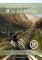
The official guide to New Zealand`s greatest walk.

This is the guidebook of Te Araroa Trail: The Long Pathway, a continuous trail running from Cape Reinga to Bluff, 35 years in the making, which officially opened in late 2011. The book maps the 3000-kilometre trail in 40-kilometre sections, with maps by leading map maker Roger Smith of Geographx.

Author Geoff Chapple is a modern-day visionary who took the concept of a continuous trail running the length of New Zealand and turned it into a reality. Until recently the CEO of the Trust, Chapple complements the maps with a running commentary describing the landscape, the flora and fauna encountered along the way, as well as the special features of particular parts of the trail. Photographs of the trail illustrate each section.

Each of the 12 regional sections opens with a stunning 2-page 3D map. A short introduction describes the history of the trail as well as the variety of New Zealand`s landscape along the way: forest, farmland, volcanoes and mountain passes, river valleys, green pathways and the urban areas of seven cities. This book is an accessible guide both for those who only want to walk parts of the trail and dedicated trampers who intend to walk its entire length.

Kartenausschnitt

Kartenbeispiel

Te Araroa - A Walking Guide to New Zealand`s Long Trail 113 Walks from Cape Reinga to Bluff - including Day Walks & Long Tramps - by Geoff Chapple - Randomhouse Neuseeland
EAN / ISBN: 9781869797140
Preis: EUR 59.90

Dieser Titel ist momentan nicht lieferbar.
Produkt EUR Anzahl Bestellen
Te Araroa - A Walking Guide to New Zealand`s Long Trail 113 Walks from Cape Reinga to Bluff - including Day Walks & Long Tramps - by Geoff Chapple - Randomhouse Neuseeland 59.90
Versandkostenfrei in Deutschland

incl. MwSt.

Stichworte, die bei der Suche nützlich sein könnten:
Te Araroa Trail - Neuseeland Wanderführer - Araroa - Newseeland - Neuseeland - Neuseeland Wanderkarten - Neuseeland Karten - Neuseeland Radwanderführer - Neuseeland Kartographie - Neuseeland Landkarten - Neuseeland Fahrradkarten - Neuseelandkarten - Neuseeland Atlanten - Neuseeland Landkartenverkauf - Neuseeland Reiseführer - Neuseeland Straßenkarten - Neuseeland Kartografie - Neuseeland Radwanderkarten - New Zealand - New Zealand Radwanderkarten - New Zealand Kartographie - New Zealand Landkarten - New Zealand Straßenkarten - New Zealand Fahrradkarten - New Zealandkarten - New Zealand Reiseführer - New Zealand Radwanderführer - New Zealand Kartografie - New Zealand Atlanten - New Zealand Landkartenverkauf - New Zealand Wanderkarten - New Zealand Karten

Zuletzt angesehene Artikel:

CoverTe Araroa - A Walking Guide to New Zealand`s Long Trail 113 Walks from Cape Reinga to Bluff - including Day Walks & Long Tramps - by Geoff Chapple - Randomhouse Neuseeland

CoverThüringen Verwaltungskarte Thüringer Landesvermessungsamt

CoverNP102 Makalu Region 1:100.000 Trekkingkarte Amphu Labsta - Mera Peak - The High Passes - (wasserfest) - Himalayan MapHouse
Makalu Region 1:100.000 GHT (Great Himalayan Trail) trekking map (NP102) - (weatherproof) - Himalayan MapHouse

Noch kein Cover vorhandenVos 30 Itineraires Autour de Toulouse Wanderführer RANDO EDITIONS

CoverN441 Laukaa Topographische Karte 1:50.000 EUREF-FIN (Maastokarttat) Maanmittauslaitos / Lantmäteriverket Finnland - ProjektNord

CoverDeutschland 1:900.000 Laminierte Landkarte - comfort!map
Germany ExpressMap

Noch kein Cover vorhanden4630 Schernberg Topographische Karte Thüringen 1:25.000 Landesvermessungsamt Thüringen

CoverInsel Wollin und Umgebung Wandern und Radfahren - Reiseführer + Landkarte 1:100.000 von Martin Zamorski und Wolfgang Abraham Rajd Verlag Polen / Wydawnictwo Rajd

Cover034 Fort Augustus, Glen Roy & Glen Moriston - Wanderkarte Großbritannien 1:50.000 Active Laminiert LANDRANGER MAP - Ordnance Survey

CoverTrossachs North / Loch Lyon / Crianlarich XT25 - Wanderkarte 1:25.000 Harvey Maps Großbritannien

CoverMosel - Ferienregion Schweich an der Römischen Weinstraße mit Meulenwald (Blatt 30) 1:25.000 inkl. Moselsteig-Etappen, Moselsteig-Seitensprüngen & Mountainbikerouten : Mosel Weinkulturland - Eifelverein e.V.

CoverEuroVelo6 - Radstrecke vom Atlantik bis zum Rhein (Atlantik - Basel) 1:100.000 - Die offizielle EuroVeloRoute6

CoverKleine Beskiden Wanderkarte 1:40.000 (Westbeskiden) Papierausgabe
Beskid Mały Compass - Polen

Noch kein Cover vorhanden4552 Weißkollm Amtliche Topographische Landkarte 1:25.000 (Präsentationsgrafik) - Landesvermessungsamt Sachsen

CoverBrocken 1:25.000 - wetterfest Wanderkarte + Radwanderkarte Harz KKV - Kartographische Kommunale Verlagsgesellschaft

CoverGR 107 EL CAMÍ DELS BONS HOMES - BERGA - FOIX 1:50.000 Wanderkarten - Spanien ALPINA

Cover3027 Faßberg Amtliche topographische Karte 1:25.000 Landesvermessungsamt Niedersachsen

CoverProvidence Stadtplan 1:36.000 (Rhode Island - USA)
Providence street map GM Johnson

CoverTolna Komitat-Atlas Stadtplan- und Ortsplan-Atlas
Tolna megye atlasz Hiszi-Map Ungarn

CoverSchlesien - Raum Teschen 1:90.000 Touristische Landkarte
ŚLĄSK CIESZYŃSKI mapa krajoznawcza Compass - Polen