Willkommen bei MapFox
Wurde Ihre Bestellung bestätigt? Wenn nicht - gab es evtl. ein SERVER-Problem! Bitte kontaktieren Sie uns! +++ Buchhändler-Anfragen erwünscht +++
Warenkorb
Artikel: 0 - € 0.00
Zur Kasse
Impressum Kontakt Versandkosten AGB
Discover The Isle of Bute - Wanderkarte (wasserfest) Visitor Map - Footprint Maps - Stirling Surveys
<< Schottland
<< Großbritannien: Wanderkarten, Radwanderkarten und MTB-Karten
<< Stirling Surveys - Footprint Maps
 
Cover

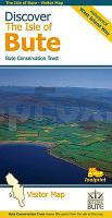
This map is the perfect companion to take exploring the island, it`s packed with information on how to get to Bute, what to see or do - and where to go, once you`re there.

The map features Scotland`s first long-distance footpath, the 30-mile West Island Way, alongside popular shorter walks.

As you`ll discover, Bute`s treasures include Mount Stuart, St Blane`s Church, Rothesay Castle and Scotland`s finest toilets!

Kartenausschnitt

Discover The Isle of Bute - Wanderkarte (wasserfest) Visitor Map - Footprint Maps - Stirling Surveys
EAN / ISBN: 9781871149821
Preis: EUR 13.90

Bestellartikel: versandfertig in ca. 1-3 Wochen. Dieser Artikel wird speziell für Sie bestellt. Keine Rücknahme!
Produkt EUR Anzahl Bestellen
Discover The Isle of Bute - Wanderkarte (wasserfest) Visitor Map - Footprint Maps - Stirling Surveys 13.90
Versandkostenfrei in Deutschland ab 30,- Bestellwert

incl. MwSt.

Stichworte, die bei der Suche nützlich sein könnten:
Schottland Wanderkarte - Isle of Bute - Insel Bute Wanderkarte - Großbritannien Wanderkarte - Schottland - Schottland Landkartenverkauf - Schottland Atlanten - Schottland Kartographie - Schottland Wanderkarten - Schottland Radwanderkarten - Schottland Kartografie - Schottland Fahrradkarten - Schottland Reiseführer - Schottland Radwanderführer - Schottlandkarten - Schottland Landkarten - Schottland Karten - Schottland Straßenkarten - Großbritannien Wanderkarten - Großbritannien Fahrradkarten - Großbritannien Mountainbike-Karten - Schottland Wanderkarten - Großbritannien Wanderkarten - Stirling Surveys - Footprint Maps - UK Hiking maps - Great Britain walking maps

Zuletzt angesehene Artikel:

CoverDiscover The Isle of Bute - Wanderkarte (wasserfest) Visitor Map - Footprint Maps - Stirling Surveys

CoverW261 Pfullendorf - Wanderkarte Schwäbische Alb 1:25.000 Deggenhausertal, Illmensee - von Schwäbischer Albverein / LGL - Landesamt für Geoinformation und Landentwicklung Baden-Württemberg (LGL)

CoverIndre Etnefjell - Langfoss - Etne - Sauda - Husnes - Åkrafjorden - Halsnøy - Uskedalen - Ølen Topographische Wanderkarte Topo 3000 - 1:50.000 (Blatt 3023) - Nordeca - Norwegen

CoverGPC3 Nördliche Ägäis 1:518.000 Seekarte Griechenland - WGS84
GPC3 Βόρειο Αιγαίο / Vorio Egaio / Northern Eagean Sea - Sea Chart - Pilot Chart Eagle Ray Griechenland