Willkommen bei MapFox
Wurde Ihre Bestellung bestätigt? Wenn nicht - gab es evtl. ein SERVER-Problem! Bitte kontaktieren Sie uns! +++ Buchhändler-Anfragen erwünscht +++
Warenkorb
Artikel: 0 - € 0.00
Zur Kasse
Impressum Kontakt Versandkosten AGB
A Pilgrim`s Guide to the Camino Sanabrés & Camino Invierno by John Brierley Caminoguides - Findhorn Press
<< Caminoguides - Jakobsweg
<< Jakobsweg
 
Cover

144 pages paperback in full colour including:

- Overview route planners
- Daily stage maps
- Contour guides
- Alternative routes & detours
- Detailed town plans
- List of all pilgrim hostels & hotels
- Historical notes
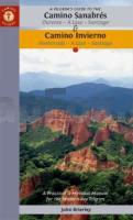
- Myths and Legends?

This guidebook combines two ancient routes into Santiago that remain largely undiscovered despite their historic significance. Each route offers a very different camino experience but are combined in one volume as they join in A Laxe for the final stages. Each provides the minimum distance required for a pilgrim to apply for a Compostela; but that is not the purpose of this guidebook which seeks to off er alternatives to the busy routes through Sarria and Tui which account for over 80% of all pilgrims to Santiago; by contrast the Camino Invierno currently carries less than 1%.

Camino Sanabrés offers a link from the Via de le Plata. This guide offers the last 5 stages of that itinerary commencing in Ourense with its rich Roman heritage and extant thermal baths. Excellent rail and road links make the city highly accessible for pilgrims wishing to commence their journey from this point. The acorn would be a fitting symbol for this route that winds its way through ancient oak forest past the Pico Santo into Santiago.

Camino Invierno provides a link from the Camino Francés and a wonderful alternative to the routes through Sarria which carry such a large volume of pilgrims. The ?Winter Way’ is a camino in its own right as it snakes its way through the mystery of Las Médulas, the largest gold mines in the Roman Empire and now a World Heritage Site (see cover photo). It continues along the sacred banks of the río Sil, the incomparable Ribeira Sacra with its vineyards and chestnut forests. Its remote location and limited facilities make this a demanding route, well suited for the seasoned pilgrim with an adventurous spirit, seeking a quieter way.

This guidebook also seeks to find a balance between the outer and inner journey, between the physical and spiritual, which is why it is subtitled A Practical & Mystical Manual - that we might find a place to eat and sleep at the end of a hard day’s walk but also, and crucially, that we might find the courage to dive into the mystery of our own soul awakening.

A Pilgrim`s Guide to the Camino Sanabrés & Camino Invierno by John Brierley Caminoguides - Findhorn Press
EAN / ISBN: 9781912216260
Preis: EUR 22.90

Bestellartikel: versandfertig in ca. 2 Wochen oder länger. Dieser Artikel wird speziell für Sie bestellt. Keine Rücknahme!
Produkt EUR Anzahl Bestellen
A Pilgrim`s Guide to the Camino Sanabrés & Camino Invierno by John Brierley Caminoguides - Findhorn Press 22.90
Versandkostenfrei in Deutschland ab 30,- Bestellwert

incl. MwSt.

Stichworte, die bei der Suche nützlich sein könnten:
Jakobsweg Spanien - Way of St. James - Camino de Santiago - Jakobsweg - Jakobsweg - Camino de Santiago - Santiago de Compostela - Camino Primitivo - Camino Portugués - Camino Portugues - Camino Portugués - John Brierley - Findhorn Press - Jakobsweg - Santiago-de-Compostela - Santiago de Compostela - Santiago de Compostella

Zuletzt angesehene Artikel:

CoverA Pilgrim`s Guide to the Camino Sanabrés & Camino Invierno by John Brierley Caminoguides - Findhorn Press

Cover2819 Lilienthal Topographische Wanderkarte 1:25.000 Niedersachsen mit Wanderwegen - ProjektNord

Cover0889-3 EL SABINAR Topographische Landkarte 1:25.000 Spanien (Grundlage MTN25) Instituto Geográfico Nacional - CNIG Spanien - ProjektNord

CoverAndros (Blatt 10.21) Topografische Wanderkarte griechische Inseln - Kykladen - Ägäis - 1:27.000 (wasserfest) - Anavasi - Griechenland
Ανδρος - Andros

Cover0959-2 CALAÑAS Topographische Landkarte 1:25.000 Spanien (Grundlage MTN25) Instituto Geográfico Nacional - CNIG Spanien - ProjektNord

CoverR 1 Clervaux / Huldange GPS 1:20.000 mit Wanderwegen - Wanderkarte Luxemburg

CoverFernwanderweg Trappistenabteien in Wallonien Wandel-Gids Belgien (flämisch)
Grote Routepad van de trappistenabdijen van Wallonië GRSentiers - Grote Routepaden

Noch kein Cover vorhandenN-33-95-A/B Czluchow Amtliche topographische Landkarte Polen 1:50.000
N-33-95-A/B Czluchow - Mapa Topograficzna Polski Glowny Geodeta Kraju

Cover0576 CABEZUELA DEL VALLE Topographische Landkarte 1:50.000 Spanien (Grundlage MTN50) Instituto Geográfico Nacional - CNIG Spanien - ProjektNord

Cover0502-4 NARROS DE MATALAYEGÜA Topographische Landkarte 1:25.000 Spanien (Grundlage MTN25) Instituto Geográfico Nacional - CNIG Spanien - ProjektNord

Cover2411-IV-NV Topographische Karte Dänemark 1:25.000
Topografisk kort Danmark (DTK/Kort25) 2411-IV-NV ProjektNord - Kort & Matrikelstyrelsen / Geodætisk Institut

Cover0160-4 BENAVIDES DE ÓRBIGO Topographische Landkarte 1:25.000 Spanien (Grundlage MTN25) Instituto Geográfico Nacional - CNIG Spanien - ProjektNord

Noch kein Cover vorhandenNyboe Land (Blatt 6) 1:500.000 Ultima Thule Serie (Gelbe Serie) Topographische Landkarte Saga Maps Grönland

Cover0238 VILLAGONZALO PEDERNALES Topographische Landkarte 1:50.000 Spanien (Grundlage MTN50) Instituto Geográfico Nacional - CNIG Spanien - ProjektNord

Cover0831 ZALAMEA DE LA SERENA Topographische Landkarte 1:50.000 Spanien (Grundlage MTN50) Instituto Geográfico Nacional - CNIG Spanien - ProjektNord

Cover02-31 Litvinov Topographische Karte 1:50.000 der Tschechischen Republik
Zakladní mapa Ceská republika - Cesky urad zememericky a katastralni - ProjektNord

CoverCambrian Way South XT40 - Long Distance Route - Wanderkarte 1:40.000 Cardiff to Devil´s Bridge - HARVEY MAPS

CoverCsorvas Stadtplan 1:12.000
Csorvás Hiszi-Map Ungarn

Cover0317-3 VINUESA Topographische Landkarte 1:25.000 Spanien (Grundlage MTN25) Instituto Geográfico Nacional - CNIG Spanien - ProjektNord

CoverCamino de Santiago Teil 1 (Blatt: 4002) - 1:50.000 - Saint-Jean-Pied-de-Port to Santo Domingo de la Calzada - Great Treks Topographic Map Guides - National Geographic