 The only sheet map for Torres del Paine that shows all accommodation, food and transport options. The O, W and Q treks are set out in full. Also, shows day-hikes. Perfect for planning and navigation.
1:40,000 - larger scale and more detail than other sheet maps.
Made specifically for Torres del Paine by Knife Edge Outdoor Guidebooks:
- Facilities marked on map: accommodation, food, transport
- Full elevation profiles
- Distance, time and elevation gain/loss provided for each stage
- English/French/German map key
- 1:40,000
- Includes free GPX downloads for the trail
- GPS compatible
- Tougher than traditional maps: try to tear me!
- More water-resistant than traditional maps
- Lighter than traditional maps
The peaks of Torres del Paine National Park are some of the most distinctive in the world. The park is named after the spectacular Torres del Paine: three imposing granite pillars, overlooking a surreal turquoise lake, which are the favourites of so many trekkers that their status is practically mythical.
However, the famous Cuernos del Paine are even more beautiful: so strikingly unusual that they could almost be the setting of a children`s fantasy story, their otherworldly appearance is hauntingly beautiful and utterly unforgettable, especially at sunrise and sunset. There are legions of other beautiful mountains too: they are steep-sided, jagged, swathed in vast blankets of the whitest snow, adorned with enormous sparkling glaciers and unattainably high. This wonderful mountain range is best experienced on one of the park`s incredible treks: the O, the W and the Q.  Kartenbeispiel Kartenbeispiel
|
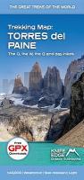
Torres del Paine - Trekking Map 1:40.000 - The O, the W, the Q and day-hikes - Knife Edge Outdoor Guidebooks
EAN / ISBN: 9781912933563
Preis: EUR 22.90
|
|


