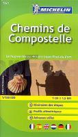
 Sinnvoller handlischer Taschenatlas über den französichen Jakobsweg (Chemins de Compostelle). Auf jeder Doppelseite ist etwa die Entfernung einer Tagesetappe mit detaillierter Übersichtskarte und Höhenprofil dargestellt. Außerdem sind Adressen von Herbergen mit kurzem Steckbrief abgedruckt. Mit Innenstadtplan von Le Puy, Figeac, Cahors und Condom. Am Schluss des Atlasses befinden sich einige Seiten mit Stempelfeldern.  Kartenausschnitt Kartenausschnitt
Kartenbeispiel
|
Französischer Jakobsweg Puy-en-Velay - St-Jean-Pied-de-Port - Taschenatlas 1:150.000 (Nr. 161) Michelin
Chemins de Compostelle
EAN / ISBN: 9782067174016
Preis: EUR 9.95
|
|


