| << Belgien: Radwanderkarten und Fahrradführer von verschiedenen Anbietern << Mini-Ardenne |
  | |
Zuletzt angesehene Artikel:
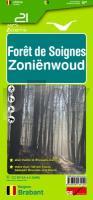
![]() | 21 Foret de Soignes - Zonienwoud 1:25.000 - 740 km Wanderwege Touristische Landkarte und Wanderkarte, Radwanderkarte, Reitkarte - Mini Ardenne - Belgien |
![]() | 2711SB Craonne - Beaurieux GPS Amtliche Topographische Wanderkarte Frankreich 1:25.000 - série bleue (IGN) |
![]() | 2224 07 Kätkänjoki Topographische Karte 1:20.000 (Maastokartta / Peruskartta / Grundkarta) Maanmittauslaitos / Lantmäteriverket Finnland - ProjektNord |
![]() | 2019SB Cloyes-sur-le-Loir - la Chapelle-du-Noyer GPS Amtliche Topographische Wanderkarte Frankreich 1:25.000 - série bleue (IGN) |
![]() | 24 Unterengadin - Scuol - Samnaun - Wanderkarte Schweiz 1:40.000 wasserfest - Kümmerly & Frey |
![]() | 213 BASEL 1:50.000 - Leimental - Lörrach - Pratteln - Topographische Landeskarte der Schweiz - swisstopo |
![]() | 58-541 Aalen - Oberkochen 1:25.000 - Wanderkarte mit Radwegen - NaturNavi |
![]() | 5442 Aue - Geologische Karte 1:25.000 (GK25 (N)) Grundlage Topographische Karte Sächsisches Landesamt für Umwelt, Landwirtschaft und Geologie |
![]() | 3421 05 Temmes Topographische Karte 1:20.000 (Maastokartta / Peruskartta / Grundkarta) Maanmittauslaitos / Lantmäteriverket Finnland - ProjektNord |
![]() | 224 Faaker See - Ossiacher See - Villach - Dreiländereck - Unteres Gailtal 1:50.000 *** SCHNÄPPCHEN *** - Wanderkarte / Radwanderkarte / Wintersportkarte Österreich - GPS - Freytag & Berndt |
![]() | 2812-III Rønne Topographische Karte Dänemark 1:50.000 - Kort & Matrikelstyrelsen ProjektNord |
![]() | 5319 Londorf Topographische Landkarte Hessen 1:25.000 - ProjektNord (geplottete Ausgabe) |
![]() | 2748-NO Topographische Karte 1:10.000 - Landesvermessungsamt Brandenburg |
![]() | 2320SB Châteauneuf-sur-Loire - Sully-sur-Loire GPS Amtliche Topographische Wanderkarte Frankreich 1:25.000 - série bleue (IGN) |
![]() | 5837 Weißenstadt Topographische Landkarte Bayern 1:25.000 - Normalausgabe - ProjektNord (geplottete Ausgabe) - Grundlage amtliche Topographische Karte Bayern DTK25 |
![]() | 2244 07 Saarijärvi Topographische Karte 1:20.000 (Maastokartta / Peruskartta / Grundkarta) Maanmittauslaitos / Lantmäteriverket Finnland - ProjektNord |
![]() | Ungarn Autoatlas 1:250.000 (A5) - mit 100 Ortsplänen Magyarország autoatlasz Dimap |
![]() | 5054 Zittau-Nord (88) - Geologische Karte 1:25.000 (GK25) Grundlage Messtischblatttopographie Sächsisches Landesamt für Umwelt, Landwirtschaft und Geologie |
![]() | 26 Lough Allen - Wanderkarte Nord-Irland 1:50.000 DISCOVERER MAP - Ordnance Survey |
![]() | 254 Topographische Landkarte Wanderkarte und Fahrradkarte Portugal 1:25.000 254 Mapa topográfico - Mapa de caminhadas - Portugal 1:25.000 ProjektNord |


