| << Jakobsweg |
  | |
Zuletzt angesehene Artikel:
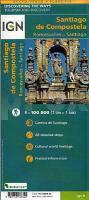
![]() | Jakobsweg Roncevaux - Compostelle (spanischer Teil) - Touristische Karte 1:100.000 (waserfest) St-Jacques de Compostelle - De Roncevaux à Compostelle - Découverte des chemins IGN Frankreich |
![]() | 43-558 Limburg a.d. Lahn und Umgebung 1:25.000 - Wanderkarte mit Radwegen, Elz, Diez, Hadamar, Hünfelden - NaturNavi |
![]() | 0483-2 TORRECABALLEROS Topographische Landkarte 1:25.000 Spanien (Grundlage MTN25) Instituto Geográfico Nacional - CNIG Spanien - ProjektNord |
![]() | 4328 Bad Lauterberg im Harz Topographische Wanderkarte 1:25.000 Niedersachsen mit Wanderwegen - ProjektNord |
![]() | LOIRE-ATLANTIQUE D44 (Blatt D44) Département-Landkarte Frankreich 1:100.000 LOIRE-ATLANTIQUE - Carte départementale - IGN Frankreich |
![]() | 02-23-05 Topographische Karte 1:10.000 der Tschechischen Republik Zakladní mapa Ceská republika - Cesky urad zememericky a katastralni - ProjektNord |
![]() | 0762-2 TOMELLOSO Topographische Landkarte 1:25.000 Spanien (Grundlage MTN25) Instituto Geográfico Nacional - CNIG Spanien - ProjektNord |
![]() | 2718 Osterholz-Scharmbeck Amtliche topographische Karte 1:25.000 Landesvermessungsamt Niedersachsen |
![]() | 2231SB Royère-de-Vassivière - Gentioux-Pigerolles GPS Amtliche Topographische Wanderkarte Frankreich 1:25.000 - série bleue (IGN) |
![]() | 23-144 Topographische Karte 1:25.000 der Tschechischen Republik Zakladní mapa Ceská republika Cesky urad zememericky a katastralni - ProjektNord |
![]() | 1011-2 CHARCHES Topographische Landkarte 1:25.000 Spanien (Grundlage MTN25) Instituto Geográfico Nacional - CNIG Spanien - ProjektNord |
![]() | 196-4 LEDIGOS Amtliche topographische Landkarte 1:25.000 Spanien (M.T.N.) 196-4 Mapa Topográfico Nacional de Espana (MTN25) Instituto Geográfico Nacional - CNIG Spanien |
![]() | 0177-2 BIESCAS Topographische Landkarte 1:25.000 Spanien (Grundlage MTN25) Instituto Geográfico Nacional - CNIG Spanien - ProjektNord |
![]() | Sobrepuerto: Pelopin - Manchoya - Cancias - Oturia - Wanderkarte - MTB bicycle map&guide Pirineo Aragones - 1:40.000 - Spanien - Wanderkarte (spanisch) ALPINA |
![]() | 15-343 Topographische Karte 1:25.000 der Tschechischen Republik Zakladní mapa Ceská republika Cesky urad zememericky a katastralni - ProjektNord |
![]() | N541 Rääkkylä Topographische Karte 1:50.000 EUREF-FIN (Maastokarttat) Maanmittauslaitos / Lantmäteriverket Finnland - ProjektNord |
![]() | 32-212 Topographische Karte 1:25.000 der Tschechischen Republik Zakladní mapa Ceská republika Cesky urad zememericky a katastralni - ProjektNord |
![]() | San Carlos de Bariloche - Regionalkarte 1:160.000 Laminierte Straßenkarte - infoMAP NINGIT Argentinien NINGIT Argentinien |
![]() | SOMME - AMIENS - ABBEVILLE - PNR BAIE DE SOMME PICARDIE MARITIME (Blatt D80) Département-Landkarte Frankreich 1:100.000 SOMME - Carte départementale - IGN Frankreich |
![]() | 13-424 Topographische Karte 1:25.000 der Tschechischen Republik Zakladní mapa Ceská republika Cesky urad zememericky a katastralni - ProjektNord |


