Willkommen bei MapFox
+++ Buchhändleranfragen willkommen! Tel. 0431-666 75 99 +++
Warenkorb
Artikel: 0 - € 0.00
Zur Kasse
Impressum Kontakt Versandkosten AGB
Aubrac à pied et à VTT - Massif Central Wanderführer - Mountainbikeführer (französisch) Chamina - Frankreich
<< Chamina - Wanderführer (französischsprachig)
 
Cover

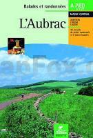
Au coeur des hautes terres, déroulant ses impressionnantes immensités, le plateau d`Aubrac profile ses horizons à l`infini, et l`herbage s`empare du paysage avec les burons, les lacs... et des couteaux célèbres nommés "Laguiole" ; le haut plateau d`Aubrac s`étire des gorges de la Truyère au nord à la vallée du Lot au sud, avec ses très beaux villages : Saint-Geniez, Espalion, Estaing...

Le guide

* 45 circuits de petite randonnée en boucle de 1h à 6h de marche en majorité réalisables à VTT
* 9 micro-balades en boucle de 20 mn à 90 mn de marche. En quelques pas, partez à la découverte d`un savoir-faire, d`un site remarquable...
* 5 grandes entités à découvrir : Haut Plateau ; Vallée du Lot et Boraldes ; Truyère et Viadène ; Truyère et Bès ; Pays de Peyre et d`Apcher
* Des pages thématiques pour tout savoir sur l`histoire, l`activité et les traditions d`un terroir.
* Des pages infos pratiques.

Aubrac à pied et à VTT - Massif Central Wanderführer - Mountainbikeführer (französisch) Chamina - Frankreich
EAN / ISBN: 9782844661401
Preis: EUR 18.90

Dieser Titel ist momentan nicht lieferbar.
Produkt EUR Anzahl Bestellen
Aubrac à pied et à VTT - Massif Central Wanderführer - Mountainbikeführer (französisch) Chamina - Frankreich 18.90
Versandkostenfrei in Deutschland ab 30,- Bestellwert

incl. MwSt.

Stichworte, die bei der Suche nützlich sein könnten:
Lozere - Lozère - Cantal - Aveyron - Chamina Frankreich - Chamina - Frankreich Wanderführer

Zuletzt angesehene Artikel:

CoverAubrac à pied et à VTT - Massif Central Wanderführer - Mountainbikeführer (französisch) Chamina - Frankreich

Noch kein Cover vorhanden215.14 Amtliche topographische Karte 1:25.000 Polen

CoverMongolei Reiseführer (englisch) das Nomaden Königreich des ewig blauen Himmels
Mongolia Nomad Empire of Eternal Blue Sky Odyssey Publications

CoverMTB Finale Ligure (Blatt MTB10) - Freeride Varigotti, Le Manie, Noli e Spotorno Topographische Fahrradkarte 1:12.500 EdM - Edizioni del Magistero - Italien

Cover21-211 Topographische Karte 1:25.000 der Tschechischen Republik
Zakladní mapa Ceská republika Cesky urad zememericky a katastralni - ProjektNord

CoverKaschubei Freizeitkarte für Aktive 1:100.000 Wanderkarte, Radwanderkarte, Freizeitkarte, Kanurouten
Kaszuby dla aktywnych mapa PLAN Galileos - Polen

Noch kein Cover vorhanden454.31 Amtliche topographische Karte 1:25.000 Polen

CoverL5730 Coburg (geplottete Ausgabe) Topographische Karte Bayern 1:50.000 Bayerisches Landesvermessungsamt

Noch kein Cover vorhandenN-34-132-A/B Kamieniuki Amtliche topographische Landkarte Polen 1:50.000
N-34-132-A/B Kamieniuki - Mapa Topograficzna Polski Glowny Geodeta Kraju

Noch kein Cover vorhanden113.32 Amtliche topographische Karte 1:25.000 Polen

CoverColorado Backpacking Loops North 1:62.360 (Blatt 1304) Trails Illustrated Map Guide Colorado - National Parks USA - National Geographic

CoverNationalpark Drage (Drawa) 1:50.000 Topographische Wanderkarte Polen
Drawienski Park Narodowy (GPS) - WZKART Polen

CoverIsola d`Elba e Arcipelago toscano (Blatt 4)1:35.000 Topographische Wanderkarte - 1:50.000 Touring-Club Italiano (TCI) Italien

Noch kein Cover vorhanden215.43 Amtliche topographische Karte 1:25.000 Polen

CoverItalien Antik Laminierte PLANO-Karte 1:1.76 Mio. (Format: 59 x 87 cm) - gerollt im Plastikrohr
Italy flat map antique - laminated National Geographic

CoverFinnland: Bärenrunde OutdoorHandbuch - Der Weg ist das Ziel (Band 85) - Hennemann Conrad-Stein-Verlag

Cover98 Gällö 1:50.000 (wasserfest) *** SCHNÄPPCHEN *** Topographische Wanderkarte - Sverigeserien Topo50 - Schweden Norstedts

Cover12-334 Topographische Karte 1:25.000 der Tschechischen Republik
Zakladní mapa Ceská republika Cesky urad zememericky a katastralni - ProjektNord

CoverGorgany Mitte 1:50.000 (laminierte Ausgabe) Topografische Wanderkarte 1:50.000 Karpaten - Ukraine
The Central Gorgany / Centralny Gorgany / Центральні Горгани - laminovana karta ASSA - Ukraine

CoverBulgarien Landkarte 1:700.000 (Blatt 739) Straßen- und Tourismuskarte mit Ortsverzeichnis und Stadtplänen von Sofia, Plovdiv und Varna
Bulgaria Michelin