 Hier erleben Radfahrer und Wanderer Geschichte hautnah, erkunden historische StÃĪtten und Orte aus dem Mittelalter. Die "StraÃe der Staufer" fÞhrt zu romantischen Kirchen und trutzigen Burgen, in denen einst die Staufer lebten. Ein HÃķhepunkt der Touristikroute durch eine der schÃķnsten Landschaften Baden-WÞrttembergs ist der Hohenstaufen: Vor Þber 800 Jahren wurde der Berg zum Stammsitz des schwÃĪbischen Adelsgeschlechtes erkoren. Tieferen Einblick in die Stauferzeit gibt eine Ausstellung zur Staufischen Geschichte am Fuà des Berges. Der rÃķmische Limes, 2005 in die Welterbeliste der UNESCO aufgenommen, ist mit einer LÃĪnge von 550 km das lÃĪngste Bodendenkmal nach der Chinesischen Mauer. An der mit Kastellen, WachtÞrmen, Mauern und Palisaden gesicherten Grenze begegnete die hoch entwickelte Kultur der RÃķmer dem barbarischen Germanien. Zahlreiche Ãberreste sind noch erhalten und zum Teil rekonstruiert worden.
|
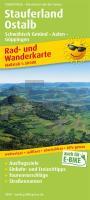
Stauferland, Ostalb, SchwÃĪbisch GmÞnd - Aalen - GÃķppingen Rad- und Wanderkarte mit StraÃennamen, Ausflugszielen, Einkehr- & Freizeittipps, wetterfest, reissfest, abwischbar, GPS-genau. 1:50000 - von - Freytag-Berndt und ARTARIA PUBLICPRESS
EAN / ISBN: 9783747305492
Preis: EUR 8.90
|
|


