
| << Europa - allgemein |
||
|
||
Zuletzt angesehene Artikel:
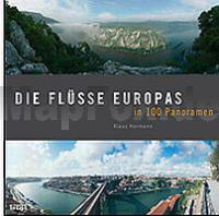
 | Die Flüsse Europas in 100 Panoramen - von Klaus Hormann - Theiss-Verlag |
 | 7543 Pfarrkirchen Topographische Landkarte Bayern 1:25.000 - Normalausgabe - ProjektNord (geplottete Ausgabe) - Grundlage amtliche Topographische Karte Bayern DTK25 |
 | W5213 Topographische Karte 1:25.000 EUREF (Peruskartta) Maanmittauslaitos / Lantmäteriverket Finnland - ProjektNord |
 | Revierführer - Kroatische Adria mit Slowenien und Montenegro - von Wolfgang Albrecht - Motorbuch |
 | 23-344 Topographische Karte 1:25.000 der Tschechischen Republik Zakladní mapa Ceská republika Cesky urad zememericky a katastralni - ProjektNord |
 | Woiwodschaft Ermland-Masuren Landkarte 1:250.000 Touristische Landkarte Warmińsko-mazurskie - podróżownik Demart - Polen |
 | 25113 Eiger - Serie Gipfel 1:25.000 Faulhorn - Grindelwald - Jungfrau - Topographische Wanderkarte der Schweiz - swisstopo |
 | Q4141 Toholampi Topographische Karte 1:25.000 EUREF (Peruskartta) Maanmittauslaitos / Lantmäteriverket Finnland - ProjektNord |
 | 1084 Große Fatra Wanderkarte Slowakei 1:50.000 Vel`ká Fatra SHOCart |
 | 21-12 Rozvadov Topographische Karte 1:50.000 der Tschechischen Republik Zakladní mapa Ceská republika - Cesky urad zememericky a katastralni - ProjektNord |
 | W432 Ranttila Topographische Karte 1:50.000 EUREF-FIN (Maastokarttat) Maanmittauslaitos / Lantmäteriverket Finnland - ProjektNord |
 | 32 - Topographische Landkarte Portugal 1:25.000 Carta Militar de Portugal - Série M888 Instituto Geográfico do Exército (IGeoE) - Portugal |
 | Ittoqqortoormiit / Scoresbysund (Blatt 20) 1:250.000 Topographische Landkarte Ostgrönland Saga Maps |
 | 21102 Borschimmen Topographische Karte 1:25.000 Messtischblatt des Deutschen Reiches - Preußische Landesaufnahme / Reichsamt für Landesaufnahme - Faksimile ProjektNord |
 | Thorn 1:20.000 Stadtplan Polen Torun Wydawnictwo Pietka - Polen |
 | P4311 Saarijärvi Topographische Karte 1:25.000 EUREF (Peruskartta) Maanmittauslaitos / Lantmäteriverket Finnland - ProjektNord |
 | Island InselTrip Reiseführer mit Insel-Faltplan und kostenloser Web-App - von Alexander Schwarz - Reise Know-How |
 | 7536 Freising Nord Topographische Landkarte Bayern 1:25.000 - Normalausgabe - ProjektNord (geplottete Ausgabe) - Grundlage amtliche Topographische Karte Bayern DTK25 |
 | Lemmenjoki Wanderkarte 1:25.000 / 1:100.000 - Finnland - Calazo Förlag |
 | Hilden Topographische Wanderkarte Nordrhein-Westfalen mit Wanderwegen und Radwegen 1:25.000 - ProjektNord |