| << Frankreich: Stadtpläne und Stadtführer << Hallwag |
  | |
Zuletzt angesehene Artikel:
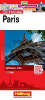
![]() | 3 in 1 City Map Paris 1:17.500 Stadtplan Map, Travel information, Highlights, Sightseeing, Index |
![]() | 356.33 Amtliche topographische Karte 1:25.000 Polen |
![]() | 04-313 Topographische Karte 1:25.000 der Tschechischen Republik Zakladnà mapa Ceská republika Cesky urad zememericky a katastralni - ProjektNord |
![]() | Arendsee - Lenzen - Wittenberge und Umgebung 1:50.000 (Nr. 244) Radwanderkarte/Wanderkarte - Verlag Dr. Barthel |
![]() | 32G BARNEVELD Topographische Karte der Niederlande 1:25.000 (Plotausgabe) 32G BARNEVELD Topografische Kaart van Nederland Kadaster - ProjektNord |
![]() | Skitouren-Erlebnis Schweiz 24 Mehrtagesskitouren und über 100 Gipfel. Mit GPS-Tracks - von Heiduk, Stephanie - Rother Bergverlag |
![]() | 023 S Sandefjord SØR 1:50.000 - Amtliche Topographische Landkarte Norwegen - Startens Kartverk |
![]() | 326.31 Amtliche topographische Karte 1:25.000 Polen |
![]() | 12-412 Rudna Topographische Karte 1:25.000 der Tschechischen Republik Zakladnà mapa Ceská republika - Cesky urad zememericky a katastralni - ProjektNord |
![]() | Welt politisch PLANO-Karte 1:37.213 Mio. (Format: ca. 111 x 77 cm) - gerollt im Plastikrohr World Map flat map National Geographic |
![]() | 342.3 Amtliche topographische Karte 1:50.000 Polen |
![]() | 354.42 Amtliche topographische Karte 1:25.000 Polen |
![]() | 05 Carta della Val Soana - Alpi Canavesane 1:20.000 Wanderkarte - Lillaz - Locano - Ribordone - MU Edizioni - Italien |
![]() | 343.2 Amtliche topographische Karte 1:50.000 Polen |
![]() | 334.33 Amtliche topographische Karte 1:25.000 Polen |
![]() | Rapid City / Black Hills / Spearfish / Badlands Natl Park Stadtplan 1:36.000 (South Dakota - USA) Rapid City / Black Hills / Spearfish / Badlands Natl Park street map Universal Map Group (Kappa) / GM Johnson |
![]() | Canada Road Atlas 1:250.000 - 1:2 Mio. Straßenatlas Kanada cccmaps Canadian Cartographics Corporation / MapArt Publishing |
![]() | Mit dem Wohnmobil nach Sachsen (Band 72) Dresden und Leipzig, Sächsische Schweiz, Erzgebirge, Zittauer Gebirge, Oberlausitz, Vogtland. Die Anleitung für einen Erlebnisurlaub. Tipps, tRicks, Touren, Tplle Plätze. Alle Plätze mit präzisen GPS-Daten - von Anette Scharla-Dey und Franz P. Tschauner - Womo-Verlag |
![]() | Leningrader Oblast - Kreis Luschki - Luga 1:100.000 - Stadtplan Luga 1:15.000 Karta LTD Sankt Petersburg Karta - Leningradskaja oblast Luschskij rajon, Luga |
![]() | Sonnensystem PLANO-Karte (Format: 62 x 47 cm) - gerollt im Plastikrohr Solar System flat map National Geographic |


