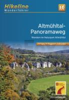
| << Bayern: Wanderführer, Kletterführer << hikeline - Esterbauer |
  | |
Zuletzt angesehene Artikel:
![]() | Fernwanderweg Altmühl-Panoramaweg - Wanderführer und Karte 1:35.000 Wandern im Naturpark Altmühltal - Hikeline Esterbauer |
![]() | Alpi Orobie Bergamasche 1:50.000 - Parco delle Orobie Bergamasche - Valle Brembana, Valle Seriana - Wanderkarte mit Broschüre (Blatt 104) KOMPASS |
![]() | NS531 Simikot to Humla 1:150.000 - Limi Valley - Nying Valley - Saipal Himal BC - Rara - Limi Lapcha La - Trekkingkarte - Himalayan MapHouse - Nepal |
![]() | Feodosia (Krim) Stadtplan 1:10.000 (russische Ausgabe) Feodosia Kartografija - ukrmap Ukraine |
![]() | Teneriffa - Teide Nationalpark - Anaga - Teno - 4 Wanderkarten 1:25.000 mit Wanderführer (spanisch) Tenerife - Parque Nacional Teide - Anaga - Teno ALPINA |
![]() | 3734 Haldensleben Topographische Karte 1:25.000 Landesamt für Vermessung und Geoinformation Sachsen-Anhalt (Landesvermessungsamt) |
![]() | Republik Tatarstan 1:200.000 Topographischer Regionalatlas Tatarstan Respublika 439 CEWKF - Russland |
![]() | 2950-NW Topographische Karte 1:10.000 - Landesvermessungsamt Brandenburg |
![]() | Kambodscha - Angkor 1:1.5 Mio. Nelles-Map Cambodia Angkor Nelles-Verlag |
![]() | 1616SB LA FERTE-MACE - PRE-EN-PAIL - CARROUGES - GPS Amtliche Topographische Wanderkarte Frankreich 1:25.000 - série bleue (IGN) |
![]() | 5639 Adorf (151) - Geologische Karte 1:25.000 (GK25) Grundlage Messtischblatttopographie Sächsisches Landesamt für Umwelt, Landwirtschaft und Geologie |
![]() | Öhavsstien Süd - Ärö & Rudeköping 1:25.000 - Calazo Outdoormaps Serie - Calazo Förlag Dänemark Øhavsstien syd - Ærø & Rudekøping Calazo Förlag Dänemark |
![]() | 58 CLARE / LIMERICK / TIPPERARY Wanderkarte Irland 1:50.000 DISCOVERY MAP - Ordnance Survey |
![]() | 2335 Langen Brütz Amtliche Topographische Karte 1:25.000 Landesvermessungsamt Mecklenburg-Vorpommern |
![]() | 5243 Burkhardtsdorf (114) - Geologische Karte 1:25.000 (GK25) Grundlage Vollbornsche Äquidistantenkarte Sächsisches Landesamt für Umwelt, Landwirtschaft und Geologie |
![]() | Tour de Manche à vélo de Cherbourg à Roscoff Radwanderführer - (französisch) Chamina - Frankreich |
![]() | Naturschutzgebiet Lüneburger Heide 1:50.000 (WKD5082) - Schneverdingen - Bispingen - Lüneburg - Wander-, Rad- und Freizeikarte - Freytag & Berndt |
![]() | 25 Wanderungen Niederländische Küste OutdoorHandbuch - Der Weg ist das Ziel (Band 394 ) von Wolfgang Barelds - Conrad-Stein-Verlag |
![]() | CC 3126 Hamburg-Ost Topographische Übersichtskarte 1:200.000 - Bundesamt für Kartografie und Geodäsie und Landesvermessungsämter - ProjektNord |
![]() | Radwander- und Wanderkarte Flusslandschaft Elbe - Stendal - Arneburg - Sandau und Umgebung 1:50.000 (Nr.243) Ausflüge zwischen der Altmark, Sandau, Arneburg, Tangermünde, Osterburg und Bismark - von Verlag Dr. Barthel - Barthel, A |


