Willkommen bei MapFox
Wurde Ihre Bestellung bestätigt? Wenn nicht - gab es evtl. ein SERVER-Problem! Bitte kontaktieren Sie uns! +++ Buchhändler-Anfragen erwünscht +++
Warenkorb
Artikel: 0 - € 0.00
Zur Kasse
Widerruf Impressum Kontakt Versandkosten AGB
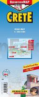
Crete 1:200.000 Straßenkarte Berndtson
<< Berndtson
<< Kreta
 
Cover

Wasserfeste Landkarte, GPS-tauglich.

Crete West, Crete East, Ágios Nikólaos, Chaniá, Gádvos, Ieráptra, Iráklio, Knossós, Réthimno, Samariá, Sitía, Time Zone (BerndtsonMAP) (Road Map/ Landkarte) [Folded Map/ Faltkarte]

BerndtsonMAP is a watersafe, durable, laminated and easy to fold road map. The BerndtsonMAP features overview and detail maps with elaborate road and street network, points of interest, public facilities, hotels, shopping centers and markets, including a time zone map as well as useful statistics, temperature, weight and measurement conversion charts, climate charts with temperatures, sunshine hours, precipitation and humidity. Special feature of the BerndtsonMAP is a selection of the 15 most popular POIs (points of interest) shown in a LocatorMAP and with short text description including opening hours and useful web-sites.

Kartenausschnitt

Kartenbeispiel

Crete 1:200.000 Straßenkarte Berndtson
EAN / ISBN: 9783865925268
Preis: EUR 9.90

Bestellartikel: versandfertig in ca. 3-7 Tagen. Dieser Artikel wird speziell für Sie bestellt. Keine Rücknahme!
Produkt EUR Anzahl Bestellen
Crete 1:200.000 Straßenkarte Berndtson 9.90
Versandkostenfrei in Deutschland ab 30,- Bestellwert

incl. MwSt.

Stichworte, die bei der Suche nützlich sein könnten:
Kreta Landkarte - Crete - Kreta - Berndtson - Berndtson & Berndtson - Berndson - Berndtson Landkarten - Berndtson Länderkarten - Berndtson Stadtpläne - Berndtson Citypläne - Berndtson City-Pläne - Berndtson maps - Berndtson city maps - Griechenland - Griechische Inseln - Griechische Mittelmeerinseln - Kreta - Kriti - Crete - Crète - Ägäisches Meer - Ägäis Landkarten

Zuletzt angesehene Artikel:

CoverCrete 1:200.000 Straßenkarte Berndtson

CoverWerse-Ems-Radweg bikeline Radwanderführer - Esterbauer

CoverLanguedoc-Roussillon - Okzitanien entdecken Reiseführer - von Petra Sparrer - Reise Know-How

CoverAugustow - Stadtplan 1:13.500
AUGUSTÓW plan miasta Cartomedia - Polen

Cover39 Sion - Sierre MTB-Karte 1:50.000 - Swiss Singletrail Map

CoverPeru 1:1.5 Mio. Landkarte Adventure Map National Geographic

CoverAthen Stadtplan 1:12.000 Domino (griechisch) - Hardcover

CoverUtah Straßenkarte 1:1.25 Mio. GuideMap National Geographic - USA

Cover1911ET Rouen Topographische Wanderkarte Frankreich 1:25.000 TOP 25 IGN - (GPS)

CoverLa Strada Romea da Rimini a Sansepolcro 1:50.000 Wanderkarte - Club Alpino Italiano / ISTITUTO GEOGRAFICO ADRIATICO

CoverMallorca 1:100.000 Übersichtskarte Freytag & Berndt

CoverAlgarve 1:100.000 Landkarte Reise-Know-How Verlag - world mapping project

CoverPeking Straßenkarte
Beijing Travel Map Periplus Editors

CoverIsland Botanische Karte - Mál og menning
Plöntukort - Botanical Map

CoverThailand: A Climbing Guide Author: Sam Lightner Jr. - THE MOUNTAINEERS

CoverRadfernweg München - Venezia bikeline Esterbauer

CoverDubai CityTrip Reiseführer Reise-Know-How Verlag
