Willkommen bei MapFox
+++ Buchhändleranfragen willkommen! Tel. 0431-666 75 99 +++
Warenkorb
Artikel: 0 - € 0.00
Zur Kasse
Impressum Kontakt Versandkosten AGB
Camino de Santiago (englisch) - The Way is the Goal St. Jean - Santiago - Finisterre - by Raimund Joos - Conrad-Stein-Verlag
<< Conrad-Stein-Verlag
<< Jakobsweg
 
Cover

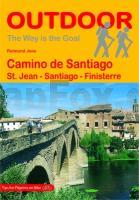
The main route of the Camino de Santiago, Camino Francés leads pilgrims over the Pyrenees. The WAY (Camino de Santiago) winds through the vineyards of Rioja into the lonely stretches of Castile, and the green hills and valleys of Galicia for some 800 km, before reaching Santiago de Compostela and its impressive Cathedral. The versatility of the landscapes, the cultural treasures of the cities along the Way, and the encounters with people from all over the world, make this hike an unforgettable experience. The author Raimund Joos, who walks this and other Ways of St. James for several months each year, describes the Camino Francés in 140 concise stages, which can be individually arranged to daily stages. Also, interesting detours and the continuing way from Santiago to Finisterre are introduced. For the current published edition, which was published in English for the first time, the descriptions were completely updated and new, improved maps, scaled 1:200.000, were painted. At every stage, overnight stays in refuges are naturally listed, so the pilgrim can easily find a place after a hard day. Information about sights along the Way and important general hints on topics such as "arrival and departure", "equipment", and "language", complete the description of the Way.

Camino de Santiago (englisch) - The Way is the Goal St. Jean - Santiago - Finisterre - by Raimund Joos - Conrad-Stein-Verlag
EAN / ISBN: 9783866865174
Preis: EUR 16.90

Bestellartikel: versandfertig in ca. 3-7 Tagen. Dieser Artikel wird speziell für Sie bestellt. Keine Rücknahme!
Produkt EUR Anzahl Bestellen
Camino de Santiago (englisch) - The Way is the Goal St. Jean - Santiago - Finisterre - by Raimund Joos - Conrad-Stein-Verlag 16.90
Versandkostenfrei in Deutschland ab 20,- Bestellwert

incl. MwSt.

Stichworte, die bei der Suche nützlich sein könnten:
Way of St. James - Conrad-Stein-Verlag - Outdoor-Verlag - Outdoor-Handbücher - Basiswissen draußen - Jakobsweg - Santiago-de-Compostela - Santiago de Compostela - Santiago de Compostella

Zuletzt angesehene Artikel:

CoverCamino de Santiago (englisch) - The Way is the Goal St. Jean - Santiago - Finisterre - by Raimund Joos - Conrad-Stein-Verlag

Cover989-3 LUCENA Amtliche topographische Landkarte 1:25.000 Spanien (M.T.N.)
989-3 Mapa Topográfico Nacional de Espana (MTN25) Instituto Geográfico Nacional - CNIG Spanien

CoverDas Tropenbuch - Vom Leben und Überleben in den Tropischen und Subtropischen Ländern Taschenbuch - Ronald Hanewald

Noch kein Cover vorhanden2466 Barkenbrügge Topographische Karte 1:25.000 Messtischblatt des Deutschen Reiches - Preußische Landesaufnahme / Reichsamt für Landesaufnahme - Faksimile ProjektNord

Cover4423 10+4441 01 Veihtivaara Topographische Karte 1:20.000 (Maastokartta / Peruskartta / Grundkarta) Maanmittauslaitos / Lantmäteriverket Finnland - ProjektNord

CoverPalermo Provinzialautokarte - Straßenkarte 1:150.000 - Italien
Palermo - Carta stradale della Provincia - Italia L.A.C. GlobalMap Italien

Noch kein Cover vorhanden3052 Königsberg in der Neumark Topographische Karte 1:25.000 Messtischblatt des Deutschen Reiches - Preußische Landesaufnahme / Reichsamt für Landesaufnahme - Faksimile ProjektNord

Noch kein Cover vorhanden52-b Topographische Landkarte Georgien 1:50.000 Geoland Maps Georgien

CoverP62 Topographische Karte 1:100.000 EUREF-FIN Maanmittauslaitos / Lantmäteriverket Finnland - ProjektNord

Noch kein Cover vorhandenHorstfeld Topographische Karte 1:25.000 Messtischblatt des Deutschen Reiches - Preußische Landesaufnahme / Reichsamt für Landesaufnahme - Faksimile ProjektNord

CoverWaldkarpaten - Vihorlatgebirge - Sempliner Weite 1:50.000 (Blatt 5043) Wanderkarte Slowakei (slowakische Ausgabe)
Poloniny, Vihorlat, Zemplínska šÃ­rava TatraPlan - Slowakei

CoverStikart Oslo: Vestmarka 1:20.000 - Wanderkarte - Norwegen - Calazo Förlag

Cover0190-4 O BARCO Topographische Landkarte 1:25.000 Spanien (Grundlage MTN25) Instituto Geográfico Nacional - CNIG Spanien - ProjektNord

Cover0280-3 LA PÓVEDA DE SORIA Topographische Landkarte 1:25.000 Spanien (Grundlage MTN25) Instituto Geográfico Nacional - CNIG Spanien - ProjektNord

CoverFolyMaps Tourenkarten Set Norwegen Süd 1:600 000 - von Ralf Schröder - Touristik-Verlag Vellmar

CoverVestvågøy Wanderkarte Norwegen 1:50.000 (Blatt 2673) - Nordeca / UGLAND / Statens Kartverk Norwegen

CoverADFC-Radtourenkarte CH2 Schweiz Ost - Oberitalienische Seen 1:160.000 - reiß- und wetterfest - E-Bike geeignet - GPS-Tracks Download - mit Knotenpunkten - mit Bett+Bike Symbolen - mit Kilometer-Angaben Von Zürich zum Lago Maggiore, von Konstanz zum Lago d´Iseo - BVA BikeMedia

CoverU444 Peurasuvanto Topographische Karte 1:50.000 EUREF-FIN (Maastokarttat) Maanmittauslaitos / Lantmäteriverket Finnland - ProjektNord

Cover0892-3 FORTUNA Topographische Landkarte 1:25.000 Spanien (Grundlage MTN25) Instituto Geográfico Nacional - CNIG Spanien - ProjektNord

CoverMARCO POLO Karten 1:200.000 Vorarlberg ? Tirol mit Oberbayern ? Südtirol