| << Thüringen: Wanderkarten 1:25.000 - 1:30.000 vom Verlag Grünes Herz << Deutschland: Wintersportkarten und Wintersportführer << Thüringer Wald << Grünes Herz: Fahrradkarten, Wanderkarten, Gewässerkarten, Freizeitkarten, Reiseführer, Wanderführer |
  | |
Zuletzt angesehene Artikel:
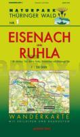
![]() | Eisenach und Ruhla (Blatt 1) Wanderkarte Thüringen 1:30.000 - Naturpark Thüringer Wald - Mit Skiloipen und Radrouten - Verlag Grünes Herz |
![]() | 783-4 CABEZARADOS Amtliche topographische Landkarte 1:25.000 Spanien (M.T.N.) 783-4 Mapa Topográfico Nacional de Espana (MTN25) Instituto Geográfico Nacional - CNIG Spanien |
![]() | 1055-2 MOTRIL Topographische Landkarte 1:25.000 Spanien (Grundlage MTN25) Instituto Geográfico Nacional - CNIG Spanien - ProjektNord |
![]() | 11 Bayerischer Wald - Deggendorf - Passau - Bad Kötzting - 1:100.000 Wanderkarte, Radkarte (ATK100) Landesamt für Vermessung und Geoinformation Bayern |
![]() | Elsass 1:210.000 Touristische Straßenkarte Frankreich (Blatt 611) Alsace - carte touristique et routière Michelin |
![]() | 75 Gedrez Amtliche topographische Landkarte 1:50.000 Spanien (M.T.N.) 75 Mapa Topográfico Nacional de Espana (MTN50) Instituto Geográfico Nacional - CNIG Spanien |
![]() | NL 33-01-08 Ost (3208-Ost) Ruhpolding Österreichische Karte 1:25.000 mit Wegmarkierungen (topographische Wanderkarte - UTM) - BEV - Österreich - Vergrößerung (ÖK25V) |
![]() | T4141 Törmäsjärvi Topographische Karte 1:25.000 EUREF (Peruskartta) Maanmittauslaitos / Lantmäteriverket Finnland - ProjektNord |
![]() | 0340 MANGANESES DE LA LAMPREANA Topographische Landkarte 1:50.000 Spanien (Grundlage MTN50) Instituto Geográfico Nacional - CNIG Spanien - ProjektNord |
![]() | Kreis Kleve mit Geldern, Moers, Venlo 1:50.000 (Nr. 3213) KOMPASS Fahrradkarte - reiß- und wetterfest - von KOMPASS-Karten GmbH KOMPASS-Karten |
![]() | 0738-1 PUERTO LÁPICE Topographische Landkarte 1:25.000 Spanien (Grundlage MTN25) Instituto Geográfico Nacional - CNIG Spanien - ProjektNord |
![]() | 53-4 (26-10) POLA DE LAVIANA Amtliche topographische Landkarte 1:25.000 Spanien (M.T.N.) 53-4 Mapa Topográfico Nacional de Espana (MTN25) Instituto Geográfico Nacional - CNIG Spanien |
![]() | 718 Iniesta Amtliche topographische Landkarte 1:50.000 Spanien (M.T.N.) 718 Mapa Topográfico Nacional de Espana (MTN50) Instituto Geográfico Nacional - CNIG Spanien |
![]() | 505-1 BLASCOMILLÁN Amtliche topographische Landkarte 1:25.000 Spanien (M.T.N.) 505-1 Mapa Topográfico Nacional de Espana (MTN25) Instituto Geográfico Nacional - CNIG Spanien |
![]() | M4124 Pälkäne Topographische Karte 1:25.000 EUREF (Peruskartta) Maanmittauslaitos / Lantmäteriverket Finnland - ProjektNord |
![]() | Vallée de l`Ubaye à pied PR 51 promenades & randonnées - Réf. P043 Topographischer Wanderführer - FFRP (Fédération française de randonnée pédestre) Frankreich |
![]() | 0629-1 BARGAS Topographische Landkarte 1:25.000 Spanien (Grundlage MTN25) Instituto Geográfico Nacional - CNIG Spanien - ProjektNord |
![]() | N5324 Heinoniemi Topographische Karte 1:25.000 EUREF (Peruskartta) Maanmittauslaitos / Lantmäteriverket Finnland - ProjektNord |
![]() | NJ 36-7 Aksaray Amtliche Topographische Karte der Türkei 1:250.000 NJ 36-7 Aksaray - Müşterek Harekat Haritası HGK |
![]() | 0644-4 POLLENÇA Topographische Landkarte 1:25.000 Spanien (Grundlage MTN25) Instituto Geográfico Nacional - CNIG Spanien - ProjektNord |


