| << Deutschland: Historische Karten und Stadtpläne (im Bereich der heutigen Bundesrepublik) << Rockstuhl |
||
|
||
Zuletzt angesehene Artikel:
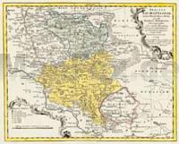
 | Das Eichsfeld (Ober- und Untereichsfeld) 1759 - Historische Landkarte Nachdruck Planokarte - gerollt von Hom. Erben - Verlag Rockstuhl |
 | 514-3 ESCAMBRONAL Amtliche topographische Landkarte 1:25.000 Spanien (M.T.N.) 514-3 Mapa Topográfico Nacional de Espana (MTN25) Instituto Geográfico Nacional - CNIG Spanien |
 | 838-2 CORTIJO DEL CARRASCALILL Amtliche topographische Landkarte 1:25.000 Spanien (M.T.N.) 838-2 Mapa Topográfico Nacional de Espana (MTN25) Instituto Geográfico Nacional - CNIG Spanien |
 | 342-1 VILLABRAGIMA Amtliche topographische Landkarte 1:25.000 Spanien (M.T.N.) 342-1 Mapa Topográfico Nacional de Espana (MTN25) Instituto Geográfico Nacional - CNIG Spanien |
 | 1037-3 ALCALA DEL VALLE Amtliche topographische Landkarte 1:25.000 Spanien (M.T.N.) 1037-3 Mapa Topográfico Nacional de Espana (MTN25) Instituto Geográfico Nacional - CNIG Spanien |
 | Dabrowa Str. Topographische Karte 1:25.000 Messtischblatt des Deutschen Reiches - Preußische Landesaufnahme / Reichsamt für Landesaufnahme - Faksimile ProjektNord |
 | 397-2 VILLARALBO Amtliche topographische Landkarte 1:25.000 Spanien (M.T.N.) 397-2 Mapa Topográfico Nacional de Espana (MTN25) Instituto Geográfico Nacional - CNIG Spanien |
 | 1065-1 IGUALEJA Topographische Landkarte 1:25.000 Spanien (Grundlage MTN25) Instituto Geográfico Nacional - CNIG Spanien - ProjektNord |
 | 0769-1 NAVARRÉS Topographische Landkarte 1:25.000 Spanien (Grundlage MTN25) Instituto Geográfico Nacional - CNIG Spanien - ProjektNord |
 | Minsk Stadtplan 1:19.000 (russisch/kyrillische Schrift) *** SCHNÄPPCHEN *** Minsk - Belkartographia Weißrussland |
 | Insel Dugi (Blatt 23) Topographische Wanderkarte 1:25.000 - Serija Dinarske Alpe Dugi Otok - Serija Dinarske Alpe - Mountaineering and Hiking map - Croatian Mountain Rescue Service Kroatischer Bergrettungsdienst - Kroatien |