| << Historische Deutschlandkarten << Rockstuhl << Reisen allgemein: Eisenbahn |
  | |
|
||
Zuletzt angesehene Artikel:
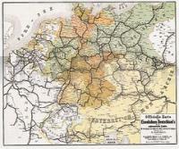
![]() | Eisenbahnen Deutschlands 1862/63 - Historische Landkarte Nachdruck Planokarte - gerollt von Hartmann, W. - Verlag Rockstuhl |
![]() | 25 Regio Rotterdam - Fahrradkarte 1:66.666 Regio Rotterdam fietskaart Regio Rotterdam - ANWB fietskaart 25 - ANWB - Niederlande |
![]() | Lefkada 1:60.000 Best of - Landkarte + Führer Best of Lefkada - Map + Guide Road Editions - Nakas Road Cartography - Griechenland |
![]() | Cycling in East Anglia 21 hand-picked rides - von Hennessy, Huw - Bradt Guides |
![]() | Görlitz, Zgorzelec Touristischer Stadtplan mit Sehenswürdigkeiten und Straßenverzeichnis. 1:14000 - von - Freytag-Berndt und ARTARIA PUBLICPRESS |
![]() | Meran Süd 1:50.000 - Supertrail Map - Mountainbikekarte - Landkarte outcomm |
![]() | NS518 Rara to Khaptad 1:150.000 Trekkingkarte - Himalayan MapHouse - Nepal |
![]() | 6010 Kirchberg (Hunsrück) Topographische Karte 1:25.000 - Landesamt für Vermessung und Geobasisinformation Rheinland-Pfalz |
![]() | 433.13 Amtliche topographische Karte 1:25.000 Polen |
![]() | Ardennes walking Belgium, Luxemburg & the Ardennes 32-day walks Wanderführer - Cicerone (englisch) |
![]() | 153-4 SOUTELO DE MONTES Amtliche topographische Landkarte 1:25.000 Spanien (M.T.N.) 153-4 Mapa Topográfico Nacional de Espana (MTN25) Instituto Geográfico Nacional - CNIG Spanien |
![]() | Altenburg / Ronneburg 1757 - Historische Landkarte Nachdruck Planokarte - gerollt von Seutter, Matthäus - Verlag Rockstuhl |
![]() | 472.4 Klodzko (Glatz) Amtliche topographische Karte 1:50.000 Polen |
![]() | 474.22 Amtliche topographische Karte 1:25.000 Polen |
![]() | Cinque Terre - Alta Via delle Cinque Terre (AV5T) - Alta Via del Golfo (AVG) (Blatt: 4006) Great Treks Topographic Map Guides - National Geographic |
![]() | 22B SLAGHAREN Topographische Karte der Niederlande 1:25.000 (Plotausgabe) 22B SLAGHAREN Topografische Kaart van Nederland Kadaster - ProjektNord |
![]() | Oregon Atlas & Gazetteer - Topographischer Straßenatlas Delorme Publishing Company DELORME MAPPING USA |
![]() | 004 S Lyngdal SØR 1:50.000 - Amtliche Topographische Landkarte Norwegen - Startens Kartverk |
![]() | 2467 Ratzebuhr Topographische Karte 1:25.000 Messtischblatt des Deutschen Reiches - Preußische Landesaufnahme / Reichsamt für Landesaufnahme - Faksimile ProjektNord |
![]() | 7: Macheiras National Forest Park - Zypern 1:50.000 Topographische Wanderkarte - Mit Wanderwegen und Radwegen ProjektNord |


