| << Deutschland: Historische Karten und Stadtpläne (im Bereich der heutigen Bundesrepublik) << Rockstuhl |
||
|
||

Zuletzt angesehene Artikel:
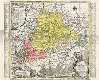
 | Altenburg / Ronneburg 1757 - Historische Landkarte Nachdruck Planokarte - gerollt von Seutter, Matthäus - Verlag Rockstuhl |
 | 2113-II-NV Topographische Karte Dänemark 1:25.000 Topografisk kort Danmark (DTK/Kort25) 2113-II-NV ProjektNord - Kort & Matrikelstyrelsen / Geodætisk Institut |
 | M4231 Sahalahti Topographische Karte 1:25.000 EUREF (Peruskartta) Maanmittauslaitos / Lantmäteriverket Finnland - ProjektNord |
 | 5811 Kestert - Wanderkarte mit Wanderwegen (geplottete Ausgabe) ProjektNord - Grundlage Amtliche topographische Karte Landesamt für Vermessung und Geobasisinformation Rheinland-Pfalz |
 | 111 - Topographische Landkarte Portugal 1:25.000 Carta Militar de Portugal - Série M888 Instituto Geográfico do Exército (IGeoE) - Portugal |
 | Les Guilleries-Collsacabra (Blatt 66) 1:25.000 Sant Hilari Sacalm, Pantà de Sau, Pantà de Susqueda - Wanderkarte Katalonien (Spanien) - Col·lecció Unitats Geogràfiques - Institut Cartogràfic de Catalunya |
 | U4424 Topographische Karte 1:25.000 EUREF (Peruskartta) Maanmittauslaitos / Lantmäteriverket Finnland - ProjektNord |