| << Deutschland: Historische Karten und Stadtpläne (im Bereich der heutigen Bundesrepublik) << Rockstuhl |
||
|
||

Zuletzt angesehene Artikel:
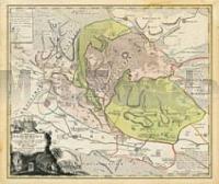
 | Grafschaft Stolberg und der Harz 1745 - Historische Landkarte Nachdruck Planokarte - gerollt von Seutter, M. - Verlag Rockstuhl |