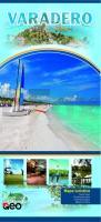
| << Kuba << Huber Kartographie |
  | |
Zuletzt angesehene Artikel:
![]() | Varadero Mapa turistico, Tourist map, Touristische Karte, Carte touristique, Mappa turistica - Huber Kartographie |
![]() | Kreis Kleve *POSTER* Topographische Kreiskarte 1:50.000 - Format: ca. 91 x 126 cm - ProjektNord |
![]() | NL 32-03-18 Ost (2218-Ost) Kundl Österreichische Karte 1:25.000 mit Wegmarkierungen (topographische Wanderkarte - UTM) - BEV - Österreich - Vergrößerung (ÖK25V) |
![]() | 4815 Schmallenberg - Wanderkarte mit Wanderwegen (geplottete Ausgabe) ProjektNord - Grundlage Amtliche topographische Karte 1:25.000 Landesvermessungsamt Nordrhein-Westfalen |
![]() | Bayerische Rhön, Bad Kissingen, Bad Neustadt a.d.S. und Umgebung - Wander- und Radwanderkarte 1:35.000 (Nr. 165) Ausflüge zwischen Frauenroth, Ramsthal, Trimberg, Münnerstadt, Nüdlingen, Aschbach und Bad Bocklet, Wander- und Radwanderkarte. GPS-fähig. 1:35000 Dr. Barthel Verlag |
![]() | China (Blatt 2: Mitte) 1:2 Mio. - geografische Karte CHINA central GiziMap |
![]() | 4911 Gummersbach (geplottete Ausgabe) Amtliche topographische Karte 1:25.000 Landesvermessungsamt Nordrhein-Westfalen |
![]() | 460.2 Amtliche topographische Karte 1:50.000 Polen |
![]() | 366.2 Amtliche topographische Karte 1:50.000 Polen |
![]() | 174 N Reisadalen NORD 1:50.000 - Amtliche Topographische Landkarte Norwegen - Startens Kartverk |
![]() | NK 37-14 Giresun Amtliche Topographische Karte der Türkei 1:250.000 NK 37-14 Giresun - Müşterek Harekat Haritası HGK |
![]() | 4431 04 Kiekinkoski Topographische Karte 1:20.000 (Maastokartta / Peruskartta / Grundkarta) Maanmittauslaitos / Lantmäteriverket Finnland - ProjektNord |
![]() | Königreich Sachsen 1864 - Historische Landkarte Nachdruck Planokarte - gerollt - von C. Gräf - Verlag Rockstuhl |
![]() | Sareks nationalpark Fjällkartan - Bergwanderkarte 1:50.000 Calazo Förlag Schweden |
![]() | 0/16 Mount Kenya Nationalpark 1:50.000 / 1:25.000 - Trekkingkarte Alpenvereinskarte - Universität Innsbruck, Kenya Wildlife Service - Walder, Judith - Deutscher Alpenverein |
![]() | Eggegebirge Nord Topographische Wanderkarte mit Wanderwegen 1:25.000 - ProjektNord |
![]() | 166 N Siebe NORD 1:50.000 - Amtliche Topographische Landkarte Norwegen - Startens Kartverk |
![]() | 4 Norwegen Nordkap - Hammerfest Straßenkarte 1:400.000 Freytag & Berndt |
![]() | 175.2 Amtliche topographische Karte 1:50.000 Polen |
![]() | Republik Mari El 1:200.000 / 1:20.000 (russisch/kyrillische Schrift) Topographischer Atlas Russland Respublika Marij El - Regionalnij Atlas - Russland |


