 Seat of government. Tourist magnet. Global metropolis. The German capital is all this and much more. Berlin combines tradition and trend, culture and partying, starred gastronomy and fast food. In modern-day Berlin, history is omnipresent - whether in the innumerable places where remnants of the wall lead us to discover traces of Germany`s division, or at the Holocaust Memorial, where the murdered Jews of Europe are commemorated. The diversity of Berlin puts the capital in the very forefront of German city tourism. The tourist city map contains descriptions of important sights, a city center map with a scale of 1 : 10.000 and a street index for fast orientation.
|
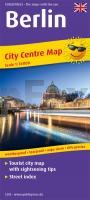
Berlin Tourist City Centre map with sightseeing tips and Street index. 1:18000 - von - Freytag-Berndt und ARTARIA PUBLICPRESS
EAN / ISBN: 9783961322039
Preis: EUR 7.90
|
|


