 Cologne is not just the cathedral. Cologne is also carnival. Cologne is cheerfulness. And Cologne is culture. Important museums, theatres and music venues have all been established within the city. There are attractions such as the `love locks? on the Hohenzollern Bridge, the Cologne cable car and the Cologne Zoo. A walk along the Rhine and through the Old Town is not to be missed. And what would a visit to Cologne be if you couldn`t mull over your impressions with a glass of Kölsch?! The tourist city map contains descriptions of important sights, an overview plan with a scale of 1 : 100.000, a city center map with a scale of 1 : 10.000 and a street index for fast orientation.
|
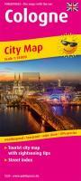
Cologne Tourist City map with sightseeing tips and Street index. 1:18000 - von - Freytag-Berndt und ARTARIA PUBLICPRESS
EAN / ISBN: 9783961322305
Preis: EUR 9.90
|
| 


