| << Russland: Oblaste und Regionen etc. << Karta LTD Sankt-Petersburg |
||
|
||
Zuletzt angesehene Artikel:
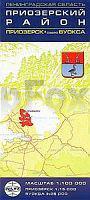
 | Leningrader Oblast - Region Priosersk 1:100.000 - Stadtplan Priosersk 1:15.000 - Wyoska-See 1:25.000 Karta - Leningradskaja oblast: Priozerskij Rajon / Priozersk, Ozero Wyoksa Karta LTD Sankt Petersburg |
 | 375-1 Castrillo de la Vega Amtliche topographische Landkarte 1:25.000 Spanien (M.T.N.) 375-1 Mapa Topográfico Nacional de Espana (MTN25) Instituto Geográfico Nacional - CNIG Spanien |
 | 423-3 TRABANCA Amtliche topographische Landkarte 1:25.000 Spanien (M.T.N.) 423-3 Mapa Topográfico Nacional de Espana (MTN25) Instituto Geográfico Nacional - CNIG Spanien |
 | 2019 Kronprinzenkoog - Gestern und Heute - Historische Überlagerung 1878-1880 Topographische Landkarte 1:25.000 im Vergleich - Landesvermessungsamt Schleswig-Holstein / ProjektNord |
 | Moskau Atlas `Zlatoglawaja` Москва Златоглавая Rus Co. Ltd. - Russland |
 | UK 50-42 München-Ost, Dorfen - Ebersberg - Erding Wanderkarte Bayern 1:50.000 mit Wanderwegen und Radwanderwegen, GPS-Gitter - Landesamt für Digitalisierung, Breitband und Vermessung (Landesvermessungsamt Bayern) |
| Skuodas (25-29/65-69) Topografische Karte Litauen 1:50.000 Lietuvos Respublikos Topografinis Zemelapis 1:50.000 - Nacionaline Zemes Tarnyba - Litauen |
 | N323 Kristinestad Topographische Karte 1:50.000 EUREF-FIN (Maastokarttat) Maanmittauslaitos / Lantmäteriverket Finnland - ProjektNord |
| 1678 Weichselmünde Topographische Karte 1:25.000 Messtischblatt des Deutschen Reiches - Preußische Landesaufnahme / Reichsamt für Landesaufnahme - Faksimile ProjektNord |
 | 699 Porreres - Mallorca Amtliche topographische Landkarte 1:50.000 Spanien (M.T.N.) 699 Mapa Topográfico Nacional de Espana (MTN50) Instituto Geográfico Nacional - CNIG Spanien |
| 2122 Krempe - Gestern und Heute - Historische Überlagerung 1878-1880 Topographische Landkarte 1:25.000 im Vergleich - Landesvermessungsamt Schleswig-Holstein / ProjektNord |
 | 762-4 PANTANO PEÑARROYA Amtliche topographische Landkarte 1:25.000 Spanien (M.T.N.) 762-4 Mapa Topográfico Nacional de Espana (MTN25) Instituto Geográfico Nacional - CNIG Spanien |
 | Kleine Fatra - Krivánska Fatra - Touristische Landkarte 1:30.000 Wanderkarte / Landkarte Slowakei Mała Fatra Krywańska (wyd pap.) Compass |