| << Rumänien: Wanderkarten von Zenith |
  | |
|
||
Zuletzt angesehene Artikel:
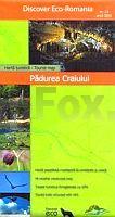
![]() | Pădurea Craiului 1:45.000 (Blatt 13) Touristische Wanderkarte - Bergwanderkarte Harta turistica / Tourist map Padurea Craiului - Adrian Patrulescu Zenith - Rumänien |
![]() | 2232 09 Pihlajaveden Topographische Karte 1:20.000 (Maastokartta / Peruskartta / Grundkarta) Maanmittauslaitos / Lantmäteriverket Finnland - ProjektNord |
![]() | PC1 Saronischer Golf 1:120.000 Seekarte Griechenland - WGS84 PC1 Σαρωνικός Κόλπος - Πλοηγικος Χάρτης / Saronikos Polkos - Sea Chart - Pilot Chart Eagle Ray Griechenland |
![]() | 3320T St. Moritz 1:33.333 Bergel - Maloja - Pontresina - Topographische Wanderkarte SAW der Schweiz wasserfest, reißfest - swisstopo |
![]() | C2734 Parchim Amtliche Topographische Karte 1:100.000 Landesvermessungsamt Mecklenburg-Vorpommern |
![]() | 7813 Emmendingen Topographische Landkarte 1:25.000 - Landesvermessungsamt Baden-Württemberg |
![]() | PYRENEES ORIENTALES (Blatt D66) Département-Landkarte Frankreich 1:100.000 PYRENEES-ORIENTALES - Carte départementale - IGN Frankreich |
![]() | 6915 Wörth am Rhein Topographische Karte 1:25.000 - Landesamt für Vermessung und Geobasisinformation Rheinland-Pfalz |
![]() | 6013 Bingen am Rhein - Wanderkarte mit Wanderwegen (geplottete Ausgabe) ProjektNord - Grundlage Amtliche topographische Karte Landesamt für Vermessung und Geobasisinformation Rheinland-Pfalz |
![]() | Genk 10d 1:10.000 Topographischer Stadtplan Belgien NGIB |
![]() | Heuscheuergebirge laminierte Wanderkarte Polen 1:35.000 Góry Stołowe Compass - Polen |
![]() | Paros - Antiparos aus der Vogelperspektive Bildband (Hardcover) Paros - Antiparos - As the seagull flies - Anavasi - Griechenland |
![]() | Puerto Rico und Amerikanische Jungferninseln 1:190.000/1:85.000 (wasserfest) Landkarte - ITMB International Travel Reference Maps (engl.) Puerto Rico & US Virgin Islands |
![]() | Walking in the Peak District - White Peak West - 40 walks in the hills of Cheshire, Derbyshire and Staffordshire - walking guide Wanderführer Cicerone Großbritannien |
![]() | 484.24 Pilchowice Amtliche topographische Karte 1:25.000 Polen |
![]() | Picardie 1:250.000 *** SCHNÄPPCHEN *** Carte Touristique - Carte routière - Découvertes Régionales IGN Frankreich |
![]() | Polen Postleitzahlenkarte 1:700.000 Wandkarte metallbestäbt in Rolle freytag & berndt |
![]() | Polen Autoatlas 1:300.000 Straßenatlas Polska atlas samochodowy Demart - Polen |
![]() | Abchasien - Sochumi - Pizunda Landkarte 1:300.000 / 1:18.000 - Georgien Abhazija - Suhum - Picunda 11 WKCh |


