Willkommen bei MapFox
Wurde Ihre Bestellung bestätigt? Wenn nicht - gab es evtl. ein SERVER-Problem! Bitte kontaktieren Sie uns! +++ Buchhändler-Anfragen erwünscht +++
Warenkorb
Artikel: 0 - € 0.00
Zur Kasse
Widerruf Impressum Kontakt Versandkosten AGB
Der Kalymnos Weg - Wanderführer (engl.)
The Kalymnos-Trail - hiking guide Terrain - Griechenland
<< Terrain Cartography (Terrain Maps) - Griechenland
<< Kalymnos
 
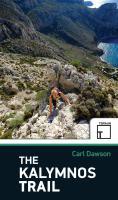
Cover

The Kalymnos Trail is a multi-day 100km trekking route around the Greek island of Kalymnos in the South Aegean. The route links many of the most interesting places on the island: mountain tops and monasteries, cliffs and castles, beaches and Byzantine ruins. None will forget the exceptional combination of blue ocean and rugged limestone mountains of this journey. This is, however, not a book for the casual stroller; the route is tough and hard. The Trail passes through complex terrain and is best suited to those with experience of hiking and scrambling in mountain environments.

The guidebook contains:

  • An introduction to the Kalymnian landscape, flora, fauna, history and archeological sites, with practical advice on hiking on the island.
  • A detailed description of The Kalymnos Trail in a series of 10 full-day or half-day hikes.
  • Maps based on the Terrain 1:25 000 series.
  • A description of 16 additional walks and hikes on the island.
  • Kartenbeispiel

    Der Kalymnos Weg - Wanderführer (engl.)
    The Kalymnos-Trail - hiking guide Terrain - Griechenland
    EAN / ISBN: 9786185160012
    Preis: EUR 19.90

Dieser Titel ist momentan nicht lieferbar.
Produkt EUR Anzahl Bestellen
Der Kalymnos Weg - Wanderführer (engl.)
The Kalymnos-Trail - hiking guide Terrain - Griechenland
19.90
Versandkostenfrei in Deutschland ab 30,- Bestellwert

incl. MwSt.

Stichworte, die bei der Suche nützlich sein könnten:
Kalymnos - Kalimnos - Griechische Inseln Wanderkarten - Griechenland Trekkingkarten - Terrain Maps - TerrainMaps - Griechenland - Griechische Inseln - Griechische Mittelmeerinseln - Kalymnos Landkarten - Kalymnos - Kalymnos Reiseführer - Kalimnos - Καλυμνος - Κάλυμνος - Ostägäis - Dodekanes - Dodecanes - Ägäis - Ägäische Inseln

Zuletzt angesehene Artikel:

CoverDer Kalymnos Weg - Wanderführer (engl.)
The Kalymnos-Trail - hiking guide Terrain - Griechenland

CoverJapan 1:1.4 Mio. comfort!map - Laminierte touristische Landkarte
Greece ExpressMap

CoverH2O Cascate di Ghiaccio Kletterführer (italienisch) - LIBRERIA ZANETTI - Italien

Noch kein Cover vorhanden1814SB Rugles - La-Ferte-Frenel GPS Amtliche Topographische Wanderkarte Frankreich 1:25.000 - série bleue (IGN)

CoverBad Gandersheim 1:25.000 Radwanderführer Harz KKV - Kartographische Kommunale Verlagsgesellschaft

Cover5233 Rudolstadt West Topographische Karte Thüringen 1:25.000 Landesvermessungsamt Thüringen

CoverIbiza & Formentera Sunflower-Wanderführer - englisch - kostenlose Updates - car tours, cycle tours & walks

CoverÜbersichtskarte Naturpark Thüringer Wald 1:140.000 - Grünes Herz

CoverTegernsee - Schliersee - Wendelstein (Baltt 8) 1:50.000 - Wanderkarte mit Broschüre KOMPASS

CoverCC 3902 Lingen (Ems) Geologische Übersichtskarte 1:200.000 - Bundesanstalt für Geowissenschaften und Rohstoffe (BGR)

Noch kein Cover vorhandenCD05 Topographische Landkarte Neuseeland 1:50.000 Land Information New Zealand

CoverKopenhagen 1:11.000 Stadtplan Borch laminiert
Copenhagen / København

Noch kein Cover vorhanden2736-NO Topographische Karte 1:10.000 - Landesvermessungsamt Brandenburg

CoverWandern in Västernorrland Medelpfad und Angermanland, einschliesslich der Hohen Küste - One Day Walks

CoverReus (Blatt 24) 1:25.000 - Wanderkarte Katalonien (Spanien) - Col·lecció Capitals Comarcals - Institut Cartogràfic de Catalunya

CoverThe Mountains of Montenegro - A Walker`s and Trekker`s Guide Wanderführer - Cicerone (englisch)

Cover50 DUBLIN / KILDARE / MEATH / WICKLOW Wanderkarte Irland 1:50.000 DISCOVERY MAP - Ordnance Survey

CoverÄgypten The premier guidebook for Business Globetrotters (englisch)
Egypt eBiz Guides

Cover163 Gravesend & Rochester - Wanderkarte Großbritannien 1:25.000 EXPLORER MAP - Ordnance Survey

CoverOL37 Cowal East - Wanderkarte Großbritannien 1:25.000 EXPLORER MAP - Active Map LAMINIERT - Ordnance Survey