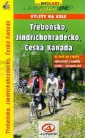
| << Tschechien: Radwanderführer << SHOCart Tschechien |
  | |
Zuletzt angesehene Artikel:
![]() | Radtourführer Wittingau - Neuhaus - Böhmisch Kanada 1:50.000 - 1:125:000 Ausflüge auf dem Rad Cyklopruvodce Trebonsko, Jindrichohradecko, Ceská Kanada - Výlety na kole SHOCart - Tschechien |
![]() | Landkarte des Weichsel-Werder-Rings Laminierte Gewässerkarte 1:158.000 - deutschsprachig Pętla Żuławska Marschallamt der Woiwodschaft Pomorskie - Polen |
![]() | 260-261 Tui Amtliche topographische Landkarte 1:50.000 Spanien (M.T.N.) 260-261 Mapa Topográfico Nacional de Espana (MTN50) Instituto Geográfico Nacional - CNIG Spanien |
![]() | M-34-104-A/B Svidnik Amtliche topographische Landkarte Polen 1:50.000 M-34-104-A/B Svidnik - Mapa Topograficzna Polski Glowny Geodeta Kraju |
![]() | Radkarte Allgäu (RK-BAY18) Kempten (Allgäu), Isny im Allgäu, Wangen im Allgäu, Immenstadt, Unterallgäu, Illertal, Nagelfluhkette, Radrunde Allgäu. GPS-tauglich mit UTM-Netz, wetterfest und reißfest - Esterbauer |
![]() | 0755 NAVALVILLAR DE PELA Topographische Landkarte 1:50.000 Spanien (Grundlage MTN50) Instituto Geográfico Nacional - CNIG Spanien - ProjektNord |
![]() | 1464 Vitte Topographische Karte 1:25.000 Messtischblatt des Deutschen Reiches - Preußische Landesaufnahme / Reichsamt für Landesaufnahme - Faksimile ProjektNord |
![]() | 537 Topographische Landkarte Wanderkarte und Fahrradkarte Portugal 1:25.000 537 Mapa topográfico - Mapa de caminhadas - Portugal 1:25.000 ProjektNord |
![]() | Pangeo (Blatt 121) Topographische Wanderkarte 1:23.000 (wasserfest) Όρος Παγγαίο - Mt. Paggaio Geopsis - Griechenland |
![]() | 4725 Bad Sooden-Allendorf - Wanderkarte mit Wanderwegen (geplottete Ausgabe) Topographische Landkarte Hessen 1:25.000 - ProjektNord (geplottete Ausgabe) |
![]() | 836-2 VILLANUEVA DE SAN CARLOS Amtliche topographische Landkarte 1:25.000 Spanien (M.T.N.) 836-2 Mapa Topográfico Nacional de Espana (MTN25) Instituto Geográfico Nacional - CNIG Spanien |
![]() | 2174 Long Topographische Karte 1:25.000 Messtischblatt des Deutschen Reiches - Preußische Landesaufnahme / Reichsamt für Landesaufnahme - Faksimile ProjektNord |
![]() | 909-4 CAÑADA DE LA CRUZ Amtliche topographische Landkarte 1:25.000 Spanien (M.T.N.) 909-4 Mapa Topográfico Nacional de Espana (MTN25) Instituto Geográfico Nacional - CNIG Spanien |
![]() | 105 Topographische Landkarte Wanderkarte und Fahrradkarte Portugal 1:25.000 105 Mapa topográfico - Mapa de caminhadas - Portugal 1:25.000 ProjektNord |
![]() | 0107 BARRUELO DE SANTULLÁN Topographische Landkarte 1:50.000 Spanien (Grundlage MTN50) Instituto Geográfico Nacional - CNIG Spanien - ProjektNord |
![]() | 60 Östra Mälaren 1:50.000 (wasserfest) *** SCHNÄPPCHEN *** Topographische Wanderkarte - Sverigeserien Topo50 - Schweden Norstedts |
![]() | 148 Vielha Amtliche topographische Landkarte 1:50.000 Spanien (M.T.N.) 148 Mapa Topográfico Nacional de Espana (MTN50) Instituto Geográfico Nacional - CNIG Spanien |
![]() | 14-142 Bartosovice v Orlickych horach Topographische Karte 1:25.000 der Tschechischen Republik Zakladní mapa Ceská republika - Cesky urad zememericky a katastralni - ProjektNord |
![]() | 193 Topographische Landkarte Wanderkarte und Fahrradkarte Portugal 1:25.000 193 Mapa topográfico - Mapa de caminhadas - Portugal 1:25.000 ProjektNord |
![]() | 1035 Villamartín Amtliche topographische Landkarte 1:50.000 Spanien (M.T.N.) 1035 Mapa Topográfico Nacional de Espana (MTN50) Instituto Geográfico Nacional - CNIG Spanien |


