| << Polen: Wassersportkarten und Wassersportführer << Polen: Pommern, Ostseeküste << Polen: Wanderkarten: Pommern, Ostseeküste << EKO-MAP Polen |
||
|
||
Zuletzt angesehene Artikel:
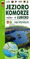
 | Komorze - Lubicko Wielkie Seen Touristische Landkarte, Wassersportkarte mit Tiefenprofilen (wasserfest) - Polen Jezioro Komorze + Lubicko - mapa batymetryczna GPS 3D - EKO-MAP |
 | 7527 Günzburg Topographische Landkarte Bayern 1:25.000 - Normalausgabe - ProjektNord (geplottete Ausgabe) - Grundlage amtliche Topographische Karte Bayern DTK25 |
 | 163 - Topographische Landkarte Portugal 1:25.000 Carta Militar de Portugal - Série M888 Instituto Geográfico do Exército (IGeoE) - Portugal |
 | 214 - Topographische Landkarte Portugal 1:25.000 Carta Militar de Portugal - Série M888 Instituto Geográfico do Exército (IGeoE) - Portugal |
 | 300 - Topographische Landkarte Portugal 1:25.000 Carta Militar de Portugal - Série M888 Instituto Geográfico do Exército (IGeoE) - Portugal |
 | 212 - Topographische Landkarte Portugal 1:25.000 Carta Militar de Portugal - Série M888 Instituto Geográfico do Exército (IGeoE) - Portugal |
 | 285-3 GURREA DE GÃLLEGO Amtliche topographische Landkarte 1:25.000 Spanien (M.T.N.) 285-3 Mapa Topográfico Nacional de Espana (MTN25) Instituto Geográfico Nacional - CNIG Spanien |
 | 469 - Topographische Landkarte Portugal 1:25.000 Carta Militar de Portugal - Série M888 Instituto Geográfico do Exército (IGeoE) - Portugal |
 | 6325 Giebelstadt Topographische Landkarte Bayern 1:25.000 - Normalausgabe - ProjektNord (geplottete Ausgabe) - Grundlage amtliche Topographische Karte Bayern DTK25 |
 | 881-4 LA CIGÃEÃUELA Amtliche topographische Landkarte 1:25.000 Spanien (M.T.N.) 881-4 Mapa Topográfico Nacional de Espana (MTN25) Instituto Geográfico Nacional - CNIG Spanien |
 | 885-1 ESTACIÃN DE SANTA ELENA Amtliche topographische Landkarte 1:25.000 Spanien (M.T.N.) 885-1 Mapa Topográfico Nacional de Espana (MTN25) Instituto Geográfico Nacional - CNIG Spanien |
 | 577 Malhada Quente (Monchique) Topographische Landkarte Portugal 1:25.000 Carta Militar de Portugal - Série M888 Instituto Geográfico do Exército (IGeoE) - Portugal |
 | 594-1/2 ALCALà DE XIVERT Amtliche topographische Landkarte 1:25.000 Spanien (M.T.N.) 594-1 Mapa Topográfico Nacional de Espana (MTN25) Instituto Geográfico Nacional - CNIG Spanien |
 | Ferienregion Zeller Land - mit Mosel und Hunsrück (ZEL) *** SCHNÃPPCHEN *** Topografische Freizeitkarte 1:25.000 mit Wander- und Radwanderwegen - Landesamt für Vermessung und Geobasisinformation Rheinland-Pfalz |
 | 712-4 Sierra del Reventón Amtliche topographische Landkarte 1:25.000 Spanien (M.T.N.) 712-4 Mapa Topográfico Nacional de Espana (MTN25) Instituto Geográfico Nacional - CNIG Spanien |
 | 584-1 MONDÃJAR Amtliche topographische Landkarte 1:25.000 Spanien (M.T.N.) 584-1 Mapa Topográfico Nacional de Espana (MTN25) Instituto Geográfico Nacional - CNIG Spanien |
 | 438-1 MIEDES DE ARAGÃN Amtliche topographische Landkarte 1:25.000 Spanien (M.T.N.) 438-1 Mapa Topográfico Nacional de Espana (MTN25) Instituto Geográfico Nacional - CNIG Spanien |
 | 601-1 CUEVA DEL ÃGUILA Amtliche topographische Landkarte 1:25.000 Spanien (M.T.N.) 601-1 Mapa Topográfico Nacional de Espana (MTN25) Instituto Geográfico Nacional - CNIG Spanien |
 | TheiÃ-See - Freizeitkarte - Topographische Radwanderkarte und Wassersportkarte Ungarn 1:50.000 wasserfest - GPS-tauglich Tisza-tó Szabadidötérkép / leisure map - Cartographia |
 | 593 Bensafrim (Lagos) Topographische Landkarte Portugal 1:25.000 Carta Militar de Portugal - Série M888 Instituto Geográfico do Exército (IGeoE) - Portugal |