
| << Polen: Wassersportkarten und Wassersportführer << Polen: Pommern, Ostseeküste << Polen: Wanderkarten: Pommern, Ostseeküste << EKO-MAP Polen |
||
|
||
Zuletzt angesehene Artikel:
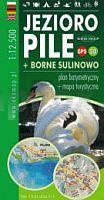
 | Pielburger See - Groß Born 1:12.500 Touristische Landkarte, Wassersportkarte mit Tiefenprofilen - Polen Jezioro Pile + Borne Sulinowo - plan batymetryczny + mapa turystyczna | GPS 3D EKO-Map - Polen |
 | ADFC-Radtourenkarte IT-PO 7-Tage-Radtour Venedig-Florenz - 1:200.000 - reiß- und wetterfest - E-Bike-geeignet - GPS-Tracks Download - mit Kilometerangaben Traumtouren zwischen Venedig, Mailand, Gardasee und Florenz. Mit Routennetz zur individuellen Planung - BVA BikeMedia |
 | 2014 08 Karis Topographische Karte 1:20.000 (Maastokartta / Peruskartta / Grundkarta) Maanmittauslaitos / Lantmäteriverket Finnland - ProjektNord |
 | NM 33-12-27 West (5327-West) Bruck an der Leitha Österreichische Karte 1:25.000 mit Wegmarkierungen (topographische Wanderkarte - UTM) - BEV - Österreich - Vergrößerung (ÖK25V) |
 | 2014 05 Pohja Topographische Karte 1:20.000 (Maastokartta / Peruskartta / Grundkarta) Maanmittauslaitos / Lantmäteriverket Finnland - ProjektNord |
 | Oblast Belgorod - Oblast Woronesch - Oblast Kursk - Oblast Lipezk - Oblast Orjol - Oblast Tambow 1:750.000 Straßenkarte / Touristenkarte - Russland Belgorodskaja, Woroneschskaja, Kurskaja, Lipezkaja, Orlowskaja, Tambowskaja oblasti Rus Co. Ltd. - Russland |
 | Elberadweg 3, Wittenberge - Cuxhaven Leporello Radtourenkarte mit Ausflugszielen, Einkehr- & Freizeittipps, wetterfest, reissfest, abwischbar, GPS-genau. 1:50000 - von - Freytag-Berndt und ARTARIA Publicpress |
 | Krasnodarer Land / Krasnodar Regionalkarte 1:720.000, Stadtplan 1:27.000 - Russland Krasnodarskij kraj - karta regiona - Krasnodar plan goroda - Administrativnoe delenie kraja. federalnie awtodorogi |
 | Oblast Kaluga - topografischer Atlas 1:200.000 Калужская область - Региональный атлас FGUP 439 Central´naja experimental´naja voenno-kartografičeskaja fabrika |
 | NL 32-03-14 West (2214-West) Bad Hindelang Österreichische Karte 1:25.000 mit Wegmarkierungen (topographische Wanderkarte - UTM) - BEV - Österreich - Vergrößerung (ÖK25V) |
| Erläuterungen zur Geologischen Karte 5140 Meerane-Crimmitschau (93) - Ausgabe 1904 Sächsisches Landesamt für Umwelt, Landwirtschaft und Geologie |
 | 1024 07 Inre Bredan Topographische Karte 1:20.000 (Maastokartta / Peruskartta / Grundkarta) Maanmittauslaitos / Lantmäteriverket Finnland - ProjektNord |
 | 578 Sao Marcos da Serra (Silves) Topographische Landkarte Wanderkarte und Fahrradkarte Portugal 1:25.000 578 Mapa topográfico - Mapa de caminhadas - Portugal 1:25.000 ProjektNord |
 | 3622 05 OSMAVAARA Topographische Karte 1:20.000 (Maastokartta / Peruskartta / Grundkarta) Maanmittauslaitos / Lantmäteriverket Finnland - ProjektNord |
 | 50E GILZE Topographische Karte der Niederlande 1:25.000 (Plotausgabe) 50E GILZE Topografische Kaart van Nederland Kadaster - ProjektNord |
| N-34-65-A/B Gorowo Ilaweckie Amtliche topographische Landkarte Polen 1:50.000 N-34-65-A/B Gorowo Ilaweckie - Mapa Topograficzna Polski Glowny Geodeta Kraju |
 | 7532 Aichach Topographische Landkarte Bayern 1:25.000 - Normalausgabe - ProjektNord (geplottete Ausgabe) - Grundlage amtliche Topographische Karte Bayern DTK25 |
 | 3213 04 Instruala Topographische Karte 1:20.000 (Maastokartta / Peruskartta / Grundkarta) Maanmittauslaitos / Lantmäteriverket Finnland - ProjektNord |
 | 4711 04 KUOSKU Topographische Karte 1:20.000 (Maastokartta / Peruskartta / Grundkarta) Maanmittauslaitos / Lantmäteriverket Finnland - ProjektNord |
 | 3424 01 Pälli Topographische Karte 1:20.000 (Maastokartta / Peruskartta / Grundkarta) Maanmittauslaitos / Lantmäteriverket Finnland - ProjektNord |