| << Polen: Wassersportkarten und Wassersportführer << Polen: Pommern, Ostseeküste << Polen: Wanderkarten: Pommern, Ostseeküste << EKO-MAP Polen |
||
|
||
Zuletzt angesehene Artikel:
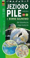
 | Pielburger See - Groà Born 1:12.500 Touristische Landkarte, Wassersportkarte mit Tiefenprofilen - Polen Jezioro Pile + Borne Sulinowo - plan batymetryczny + mapa turystyczna | GPS 3D EKO-Map - Polen |
 | MONTE PENNA (Passo del Bocco - Passo di Cento Croci - Varese Ligure) 1:25.000 - Wanderkarte (Blatt 715) - Topographische Wanderkarte Ligurien - Italien C.E. n.715 MONTE PENNA (Passo del Bocco-Passo di Cento Croci-Varese Ligure) - HIKING MAPS GEO4MAP - LIGURIA 1:25.000 Geo4 Map - Italien |
 | Forstwirtschaft Schivelbein 1:80.000 Touristische Landkarte, Wanderkarte - Polen Nadleśnictwo Świdwin mapa turystyczna + informator przyrodniczy EKO-Map - Polen |
 | 1989 Wernegitten Topographische Karte 1:25.000 Messtischblatt des Deutschen Reiches - PreuÃische Landesaufnahme / Reichsamt für Landesaufnahme - Faksimile ProjektNord |
 | 47-2 VILALBA Amtliche topographische Landkarte 1:25.000 Spanien (M.T.N.) 47-2 Mapa Topográfico Nacional de Espana (MTN25) Instituto Geográfico Nacional - CNIG Spanien |
 | N523 Heinävesi Topographische Karte 1:50.000 EUREF-FIN (Maastokarttat) Maanmittauslaitos / Lantmäteriverket Finnland - ProjektNord |
| 4257 Christianstadt Topographische Karte 1:25.000 Messtischblatt des Deutschen Reiches - PreuÃische Landesaufnahme / Reichsamt für Landesaufnahme - Faksimile ProjektNord |
 | 686 Turleque Amtliche topographische Landkarte 1:50.000 Spanien (M.T.N.) 686 Mapa Topográfico Nacional de Espana (MTN50) Instituto Geográfico Nacional - CNIG Spanien |
 | 1052-2 ALMOGÃA Amtliche topographische Landkarte 1:25.000 Spanien (M.T.N.) 1052-2 Mapa Topográfico Nacional de Espana (MTN25) Instituto Geográfico Nacional - CNIG Spanien |
 | Vorderes Zillertal, Achensee - Alpbachtal, Wildschönau Wander- und Radkarte mit Ausflugszielen & Freizeittipps, wetterfest, reiÃfest, abwischbar, GPS-genau. 1:35.000 - von - Freytag-Berndt und ARTARIA Publicpress |
 | 693-2 LAS CUEVAS Amtliche topographische Landkarte 1:25.000 Spanien (M.T.N.) 693-2 Mapa Topográfico Nacional de Espana (MTN25) Instituto Geográfico Nacional - CNIG Spanien |
 | 0747-4 SUECA Topographische Landkarte 1:25.000 Spanien (Grundlage MTN25) Instituto Geográfico Nacional - CNIG Spanien - ProjektNord |
 | 320-2 CASCANTE Amtliche topographische Landkarte 1:25.000 Spanien (M.T.N.) 320-2 Mapa Topográfico Nacional de Espana (MTN25) Instituto Geográfico Nacional - CNIG Spanien |
 | 942 (14-18) Parma del RÃo Amtliche topographische Landkarte 1:50.000 Spanien (M.T.N.) 942 Mapa Topográfico Nacional de Espana (MTN50) Instituto Geográfico Nacional - CNIG Spanien |
 | 427-4 RUBI DE BRACAMONTE Amtliche topographische Landkarte 1:25.000 Spanien (M.T.N.) 427-4 Mapa Topográfico Nacional de Espana (MTN25) Instituto Geográfico Nacional - CNIG Spanien |
 | Wladimir - Wladimirer Oblast Stadtatlas und StraÃenatlas 1:25.000 / 1:200.000 Wladimir - Wladimirskaja Oblast Rus Co. Ltd. - Russland |
 | Zaborski Landschaftspark, Nationalpark Tucheler Heide Landkarte und touristischer Reiseführer Zaborski Park Krajobrazowy, Park Narodowy Bory Tucholskie PLAN Galileos - Polen |
 | 2124 04 Mutala Topographische Karte 1:20.000 (Maastokartta / Peruskartta / Grundkarta) Maanmittauslaitos / Lantmäteriverket Finnland - ProjektNord |
 | 0504-3 ANAYA DE ALBA Topographische Landkarte 1:25.000 Spanien (Grundlage MTN25) Instituto Geográfico Nacional - CNIG Spanien - ProjektNord |
| 1 III Topographische Landkarte Portugal 1:50.000 Carta Militar de Portugal Instituto Geográfico do Exército (IGeoE) - Portugal |