| << Polen: Städte (polnisch) S... << Polen: Städte (deutsch) S... << Polen: Wanderkarten: Pommern, Ostseeküste << EKO-MAP Polen |
||
|
||
Zuletzt angesehene Artikel:
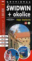
 | Schivelbein und Umgebung - Touristische Landkarte 1:80.000 Touristische Landkarte - Polen Świdwin + okolice - mapa turystyczna EKO-Map - Polen |
 | 393 Loferer und Leoganger Steinberge - Chiemgauer Alpen - Nationalpark Berchtesgaden 1:50.000 - Wanderkarte / Radwanderkarte / Wintersportkarte Ãsterreich - GPS - Freytag & Berndt |
 | Aladaglar-Gebirge (Türkei) touristische Wanderkarte 1:40.000 (engl.) - wasserfest Aladağlar Mountaıns of Turkey - Topographic Tourist Map EWP - Westcol Productions |
 | 0405-3 CARACENA Topographische Landkarte 1:25.000 Spanien (Grundlage MTN25) Instituto Geográfico Nacional - CNIG Spanien - ProjektNord |
 | 0464-2 ATEA Topographische Landkarte 1:25.000 Spanien (Grundlage MTN25) Instituto Geográfico Nacional - CNIG Spanien - ProjektNord |
 | 1011 GUADIX Topographische Landkarte 1:50.000 Spanien (Grundlage MTN50) Instituto Geográfico Nacional - CNIG Spanien - ProjektNord |
 | SENDER DE LA MEDITERRÃNIA Touristischer Wanderfürher - Wanderkarte 1:50.000 GR 92 Nord - De Portbou (Girona) a Vallvidrera (Barcelona) Editorial Alpina Spanien |
 | Böhmerwald - Eisenstein 1:25.000 (Blatt 117) Bayerisch Eisenstein - Bodenmais - Hojsova Stráž Janovice nad Ãhlavou - Lam - Nýrsko - Železná Ruda - Topographische Wanderkarte 1:25.000 Šumava - Železnorudsko Geodezie On Line - Tschechien |
 | 0206 PERALTA Topographische Landkarte 1:50.000 Spanien (Grundlage MTN50) Instituto Geográfico Nacional - CNIG Spanien - ProjektNord |
 | 689-4 RADA DE HARO Amtliche topographische Landkarte 1:25.000 Spanien (M.T.N.) 689-4 Mapa Topográfico Nacional de Espana (MTN25) Instituto Geográfico Nacional - CNIG Spanien |
 | 0903-2 CASAS DE LA ONZA Topographische Landkarte 1:25.000 Spanien (Grundlage MTN25) Instituto Geográfico Nacional - CNIG Spanien - ProjektNord |
 | 5362 Schömberg Topographische Karte 1:25.000 Messtischblatt des Deutschen Reiches - PreuÃische Landesaufnahme / Reichsamt für Landesaufnahme - Faksimile ProjektNord |
 | 0038 BERMEO Topographische Landkarte 1:50.000 Spanien (Grundlage MTN50) Instituto Geográfico Nacional - CNIG Spanien - ProjektNord |
| Plaska Topographische Karte 1:25.000 Messtischblatt des Deutschen Reiches - PreuÃische Landesaufnahme / Reichsamt für Landesaufnahme - Faksimile ProjektNord |
 | 1028 ALDEIRE Topographische Landkarte 1:50.000 Spanien (Grundlage MTN50) Instituto Geográfico Nacional - CNIG Spanien - ProjektNord |
 | 207 Prager Umland - Brdy - Pürglitzer Wald Touristische Landkarte Tschechien 1:100.000 Okolà Prahy, Brdy, Krivoklátsko - SHOCart |
 | Blatt 6A: Bocca Trabaria - San Pellegrino in Alpe 1:50.000 - Wanderkarte - Sentiero Italia CAI - Toscana-Emilia Romagna - 4land / Idea Montagna Carta itineraria del Sentiero Italia tratto Toscana-Emilia Romagna, da Bocca Trabaria a San Pellegrino in Alpe 4land / Idea Montagna |
 | 4520 Warburg - Wanderkarte mit Wanderwegen (geplottete Ausgabe) Topographische Landkarte Hessen 1:25.000 - ProjektNord (geplottete Ausgabe) |
 | N542 Joensuu Topographische Karte 1:50.000 EUREF-FIN (Maastokarttat) Maanmittauslaitos / Lantmäteriverket Finnland - ProjektNord |
 | 77-3 TORRESTÃO Amtliche topographische Landkarte 1:25.000 Spanien (M.T.N.) 77-3 Mapa Topográfico Nacional de Espana (MTN25) Instituto Geográfico Nacional - CNIG Spanien |