| << Polen: Wanderkarten: Beskiden (Tatra, Vorkarpaten) << CartoMedia Polen |
||
|
||

Zuletzt angesehene Artikel:
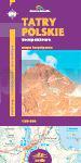
 | Polnische Tatra - Wanderkarte 1:30.000 (Blatt 412) TATRY POLSKIE kompaktowe Cartomedia - Polen |
 | 1634SB Montguyon - Brossac GPS Amtliche Topographische Wanderkarte Frankreich 1:25.000 - série bleue (IGN) |
 | Denalis West Buttress A Climber`s Guide to Mount McKinley`s Classic Route - Author: Colby Coombs Photographer: Bradford Washburn - THE MOUNTAINEERS |
 | PYRENEES ORIENTALES (Blatt D66) Département-Landkarte Frankreich 1:100.000 PYRENEES-ORIENTALES - Carte départementale - IGN Frankreich |
 | 64 Böhmerwald - Eisenstein Wanderkarte Tschechien 1:50.000 - KCT - Papierausgabe 64 Sumava - Zeleznorudsko |
 | La vélo Francette de la Normandie à L`Atlantique Radwanderführer - (französisch) Chamina - Frankreich |
 | N° 22 - Rhein Kanalführer / Waterways Giude / Guide Fluvial - WasserstraÃen-Führer Frankreich - N° 22 - Rhin Ãdition du Breil |
 | Veszprem Komitat-Atlas Stadtplan- und Ortsplan-Atlas 1:20.000 Veszprém megye atlasz Hiszi-Map Ungarn |
 | DUMONT KUNST REISEFÃHRER - Venedig Die Stadt in der Lagune -Kirchen und Paläste, Gondeln und Karneval von Droste, Thorsten |
 | The mountains / Gudbrandsdalen 1:250.000 - Jotunheimen - Rondane - Filefjell - Ãsterdalen - StraÃenkarte mit Erlebnisguide - Nordeca Norwegen The mountains Opplevelsesguide |
 | 3249 Heckelberg Topographische Karte 1:25.000 Landesvermessungsamt Brandenburg (gefaltet) |
 | W254 Laupheim - Wanderkarte 1:25.000 Ehingen (Donau) - Erbach - Schwäbischer Albverein |
 | Australien Wein-Puzzle 1.000 Teile Format 48 x 68 cm Australia Wine Puzzle 1000 p. 48 x 68 cm WATER and WINES PUZZLES |
 | 241 Schrewesbury - laminierte Wanderkarte GroÃbritannien 1:25.000 EXPLORER MAP - Ordnance Survey |
 | 026 Prealpi Giulie - Valli del Torre Topographische Wanderkarte 1:25.000 - Casa Editrice Tabacco - Italien |
 | 2814SB Vertus - Thibie GPS Amtliche Topographische Wanderkarte Frankreich 1:25.000 - série bleue (IGN) |
 | 1086 DELEMONT 1:25.000 - Bassecourt - Courrendlin - Kleinlützel - Topographische Landeskarte der Schweiz - swisstopo |
 | 1541SB Labrit - Brocas - Ygos-St-Saturnin GPS Amtliche Topographische Wanderkarte Frankreich 1:25.000 - série bleue (IGN) |
 | L4150 Burg (Spreewald) Topographische Karte 1:50.000 (Regelblattschnitt) Landesvermessungsamt Brandenburg |
 | VOSGES (Blatt D88) Département-Landkarte Frankreich 1:100.000 VOSGES - Carte départementale - IGN Frankreich |