| << Polen: Wanderkarten: Beskiden (Tatra, Vorkarpaten) << CartoMedia Polen |
||
|
||

Zuletzt angesehene Artikel:
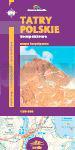
 | Polnische Tatra - Wanderkarte 1:30.000 (Blatt 412) TATRY POLSKIE kompaktowe Cartomedia - Polen |
 | 15 MARCO POLO Freizeitkarte Berlin und Umgebung 1:100.000 wasserfest, reißfest |
 | Lonely Planet Reiseführer Florida von Campbell, Jeff |
 | 4 GreenVelo: Woiwodschaft Podlachien (Südteil) 1:100.000 Radwanderkarte der Radwege Nie tylko GreenVelo - mapa tras rowerowych - Wojewodstwo Podlaskie czesc poludniowa Europilot - Daunpol - Polen |
 | 35-121 Topographische Karte 1:25.000 der Tschechischen Republik Zakladní mapa Ceská republika Cesky urad zememericky a katastralni - ProjektNord |
 | 222.1 Morag (Mohrungen) Amtliche topographische Karte 1:50.000 Polen |
 | Marokko per Wohnmobil Campingatlas Le Maroc en camping-car Guide J. Gandini - Serre Editeur |
| 113.43 Amtliche topographische Karte 1:25.000 Polen |
 | MARCO POLO Reiseatlas Frankreich 1:300.000 (Spiralbindung) |
 | 50 Metlika - Topographische Landkarte Slowenien 1:50.000 - Amtliche Kartengrundlage ProjektNord |
 | Republik Tatarstan 1:100.000 Topographischer Straßenatlas Tatarstan Respublika - Russland |
| 401.43 Amtliche topographische Karte 1:25.000 Polen |
 | 15-4 Topographische Karte 1:100.000 der Tschechischen Republik Zakladní mapa Ceská republika - Cesky urad zememericky a katastralni - ProjektNord |
 | Uruguay - Paraguay 1:1.2 Mio. Landkarte Reise-Know-How Verlag - world mapping project |
 | Il Chianti (Toskana) Wanderkarte 1:50.000 L.A.C. GlobalMap Italien |
| Alytus (60-64/25-29) Topografische Karte Litauen 1:50.000 Lietuvos Respublikos Topografinis Zemelapis 1:50.000 - Nacionaline Zemes Tarnyba - Litauen |
 | 47 Bernina - Pontresina - Val Poschiavo - Wanderkarte Schweiz 1:40.000 wasserfest - Kümmerly & Frey |
 | Niederschlesien - Breslau und Umgebung 1:220.000 - laminierte Landkarte Touristische Landkarte - comfort!map Okolice Wrocławia, Dolny Śląsk ExpressMap Polen |
 | Masserberg - Neuhaus am Rennweg - Lauscha - Steinach 1:35.000 Rad- und Wanderkarte - Kartographische Kommunale Verlagsgesellschaft mbH |
 | 234 Carnica Region - Rosental - Klagenfurt 1:40.000 - Wanderkarte / Radwanderkarte / Wintersportkarte Österreich - GPS - Freytag & Berndt |