| << Polen: Städte (polnisch) K... << Polen: Städte (polnisch) S... << Polen: Städte (deutsch) K... << Polen: Städte (deutsch) S... << CartoMedia Polen |
||
|
||

Zuletzt angesehene Artikel:
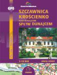
 | Szczawnica - Kroscienko nad Dunajcem - Splyw Dunajcem - Stadtpläne 1:12.500 SZCZAWNICA, KROŚCIENKO NAD DUNAJCEM, SPŁYW DUNAJCEM plany miast Cartomedia - Sygnatura Polen |
 | 4412 Unna (geplottete Ausgabe) Amtliche topographische Karte 1:25.000 Landesvermessungsamt Nordrhein-Westfalen |
 | DUMONT Reise-Taschenbuch Sardinien Cagliari - Olbia - Costa Smeralda von Nepaschink, Norbert u. Biehusen, Karl Wolfgang |
 | 0112-1 MURGIA Topographische Landkarte 1:25.000 Spanien (Grundlage MTN25) Instituto Geográfico Nacional - CNIG Spanien - ProjektNord |
 | 5205 Vettweiß (geplottete Ausgabe) Amtliche topographische Karte 1:25.000 Landesvermessungsamt Nordrhein-Westfalen |
 | 208 Uncastillo Amtliche topographische Landkarte 1:50.000 Spanien (M.T.N.) 208 Mapa Topográfico Nacional de Espana (MTN50) Instituto Geográfico Nacional - CNIG Spanien |
 | 14 - Caminha - Topographische Landkarte Portugal 1:25.000 Carta Militar de Portugal - Série M888 Instituto Geográfico do Exército (IGeoE) - Portugal |
 | 1085-2 SANTA CRUZ DE LA PALMA Topographische Landkarte 1:25.000 Spanien (Grundlage MTN25) Instituto Geográfico Nacional - CNIG Spanien - ProjektNord |
 | Tour et Traversées du Vercors, du Diois et des Baronnies GR9 / GR91 / GR93 / GR95 / GR - Réf. 0904 Topographischer Wanderführer - FFRP (Fédération française de randonnée pédestre) Frankreich |
 | 113-II (46-13) Zagama Amtliche topographische Landkarte 1:25.000 Spanien (M.T.N.) 113-II Mapa Topográfico Nacional de Espana (MTN25) Instituto Geográfico Nacional - CNIG Spanien |
 | Tananger - Stavanger - Skudenes - Seekarte Norwegische Küste 1:50.000 - (Blatt 16) Den Norske Kyst Sjøkart - Hovedkart (sjø) Statens Kartverk Sjø - Norwegen |
 | 113 Parco Naturale Alpi Marittime - Entracque - Valdieri - Mercantour - Gelas - Topographische Wanderkarte 1:25.000 - Topographische Wanderkarte 1:25.000 - IGC Italien |
 | 1013 (23-41) Macael Amtliche topographische Landkarte 1:50.000 Spanien (M.T.N.) 1013 Mapa Topográfico Nacional de Espana (MTN50) Instituto Geográfico Nacional - CNIG Spanien |
| 4253 Forst Topographische Karte 1:25.000 Messtischblatt des Deutschen Reiches - Preußische Landesaufnahme / Reichsamt für Landesaufnahme - Faksimile ProjektNord |
 | 3516 Lemförde (geplottete Ausgabe) Amtliche topographische Karte 1:25.000 Landesvermessungsamt Nordrhein-Westfalen |
| N-34-92-A/B Pisz Amtliche topographische Landkarte Polen 1:50.000 N-34-92-A/B Pisz - Mapa Topograficzna Polski Glowny Geodeta Kraju |
 | 232-4 LAGUNA DE NEGRILLOS Amtliche topographische Landkarte 1:25.000 Spanien (M.T.N.) 232-4 Mapa Topográfico Nacional de Espana (MTN25) Instituto Geográfico Nacional - CNIG Spanien |
 | 10-4 TAPIA DE CASARIEGO Amtliche topographische Landkarte 1:25.000 Spanien (M.T.N.) 10-4 Mapa Topográfico Nacional de Espana (MTN25) Instituto Geográfico Nacional - CNIG Spanien |
 | R16 Watzmann - Ramsau b. Berchtesgaden - Schönau a. Königssee - Hochkalter - Steinernes Meer ATK25 Topographische Karte 1:25.000 (Atkis) Bayern Landesvermessungsamt Bayern - Wanderkarte - Radwanderkarte |
 | 5917 Kelsterbach - Wanderkarte mit Wanderwegen (geplottete Ausgabe) Topographische Landkarte Hessen 1:25.000 - ProjektNord (geplottete Ausgabe) |