 Sehr detaillierte topographische Wanderkarte über die Pieninen / Pieniny im polnisch-slowakischen Grenzgebiet. Sonderkarten Jezioro Czorsztynskie, Trzy Korony s Sokolica Przelom Pienininski, Ortspläne Kroscienko nad Dunajcem, Szczawnica, Übersichtskarte mit Gehzeiten. Die Karte kann mit unterschiedlichen Covern geliefert werden.  Blattschnitte der Serie Blattschnitte der Serie
Slowakei-Serie TatraPlan BBKart: Blattschnitte 1:25.000 und 1:35.000 Kartenausschnitt
Kartenbeispiel
|
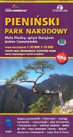
Nationalpark Pieninen (Kronenberge) 1:25.000 / 1:15.000 Touristische Landkarte und Wanderkarte Polen / Slowakei - Pieninen ohne Grenzen (Cartomedia Blatt 402 / Slowakei-Serie Blatt 2503)
Pieninski Park Narodowy - Pieniny bez granic - Sygnatura - Cartomedia Polen
EAN / ISBN: 9788374990035
Preis: EUR 9.90
|
| 


