| << Polen: Wanderkarten: Zentralpolen << CartoMedia Polen |
  | |
|
||
Zuletzt angesehene Artikel:
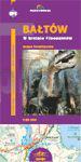
![]() | Baltow - Land der Dionosaurier Wanderkarte 1:25.000 (Blatt 331) CartoMedia (Sygnatura) Polen BAŁTÓW W krainie dinozaurów |
![]() | Muntanyes màgiques Travessa - Ripollès - Alt Bergueda - Cerdanya - Alt Urgell 1:50.000 Wanderkarte + Wanderführer Alta Cerdanya - Capcir - Andorra - Wanderkarte Spanien - ALPINA |
![]() | 352 - Topographische Landkarte Portugal 1:25.000 Carta Militar de Portugal - Série M888 Instituto Geográfico do Exército (IGeoE) - Portugal |
![]() | 25 S-Hertogenbosch Topographische Karte der Niederlande 1:100.000 (Plotausgabe) kadaster - Topografische Dienst / ProjektNord |
![]() | 0633-2 PALOMARES DEL CAMPO Topographische Landkarte 1:25.000 Spanien (Grundlage MTN25) Instituto Geográfico Nacional - CNIG Spanien - ProjektNord |
![]() | 3214 (NL 33-01-14) Kitzbühel Topographische Wanderkarte 1:50.000 mit Wegmarkierungen - Österreich - Kartographie BEV - ProjektNord |
![]() | V5142 Topographische Karte 1:25.000 EUREF (Peruskartta) Maanmittauslaitos / Lantmäteriverket Finnland - ProjektNord |
![]() | S4443 Tolja Topographische Karte 1:25.000 EUREF (Peruskartta) Maanmittauslaitos / Lantmäteriverket Finnland - ProjektNord |
![]() | 0764-1 LOS MORCILLOS Topographische Landkarte 1:25.000 Spanien (Grundlage MTN25) Instituto Geográfico Nacional - CNIG Spanien - ProjektNord |
![]() | Tatra Ostteil 1:15.000 Touristische topographische Wanderkarte Polen Tatry Wschodnie - Mapa topograficzno-turystyczna (GPS) - WZKART Polen |


