| << Polen: Wanderkarten: Ostpolen << CartoMedia Polen |
  | |
|
||
Zuletzt angesehene Artikel:
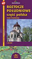
![]() | Roztocze Süd Touristische Landkarte 1:50.000 (Blatt 376) Roztocze Południowe część polska mapa CartoMedia - Polen |
![]() | 0264-3 XINZO DE LIMIA Topographische Landkarte 1:25.000 Spanien (Grundlage MTN25) Instituto Geográfico Nacional - CNIG Spanien - ProjektNord |
![]() | 479 Topographische Landkarte Wanderkarte und Fahrradkarte Portugal 1:25.000 479 Mapa topográfico - Mapa de caminhadas - Portugal 1:25.000 ProjektNord |
![]() | 426 Fuentesaúco Amtliche topographische Landkarte 1:50.000 Spanien (M.T.N.) 426 Mapa Topográfico Nacional de Espana (MTN50) Instituto Geográfico Nacional - CNIG Spanien |
![]() | 0830 HORNACHOS Topographische Landkarte 1:50.000 Spanien (Grundlage MTN50) Instituto Geográfico Nacional - CNIG Spanien - ProjektNord |
![]() | 411.1 Amtliche topographische Karte 1:50.000 Polen |
![]() | Halti - Kilpisjärvi - Pältsa Fjällkartan - Bergwanderkarte 1:50.000 - Finnland - Calazo Förlag |
![]() | 0046-3 OZA DOS RÍOS Topographische Landkarte 1:25.000 Spanien (Grundlage MTN25) Instituto Geográfico Nacional - CNIG Spanien - ProjektNord |
![]() | 021 S Nisser SØR 1:50.000 - Amtliche Topographische Landkarte Norwegen - Startens Kartverk |
![]() | LOIRE (Blatt D42) Département-Landkarte Frankreich 1:100.000 LOIRE - Carte départementale - IGN Frankreich |
![]() | 2845-SO Topographische Karte 1:10.000 - Landesvermessungsamt Brandenburg |
![]() | 4123 Stadtoldendorf Amtliche topographische Karte 1:25.000 Landesvermessungsamt Niedersachsen |
![]() | Borgafjäll - Saxnäs - Stekenjokk Fjällkartan - Bergwanderkarte 1:50.000 Calazo Förlag Schweden |
![]() | 0558-3 SEVILLA LA NUEVA Topographische Landkarte 1:25.000 Spanien (Grundlage MTN25) Instituto Geográfico Nacional - CNIG Spanien - ProjektNord |
![]() | 0013-4 AVILÉS Topographische Landkarte 1:25.000 Spanien (Grundlage MTN25) Instituto Geográfico Nacional - CNIG Spanien - ProjektNord |
![]() | 2744 Ahrensberg Amtliche Topographische Karte 1:25.000 Landesvermessungsamt Mecklenburg-Vorpommern |
![]() | Nationaler GeoPark Ruhrgebiet - Gebietsführer mit Übersichtskarte 1:125.000 Geologie zum Anschauen und Erleben - Regionalverband Ruhr |
![]() | Lonely Planet Reiseführer Singapur MAIRDUMONT |
![]() | L-34-65-A-c Amtliche Topographische Karte Ungarn 1:25.000 |


