| << Polen: Fahrradkarten und Radwanderführer << CartoMedia Polen |
||
|
||

Zuletzt angesehene Artikel:
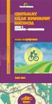
 | Radwanderweg Roztocze: Krasnik - Lemberg - Radwanderkarte 1:50.000 (Blatt 350) CENTRALNY SZLAK ROWEROWY ROZTOCZA Kraśnik-Lwów mapa turystyczna Cartomedia - Sygnatura Polen |
 | Pembookshire Coast Path - Adventure Atlas 1:25.000 Geographers` A-Z Großbritannien |
 | 45E OSS Topographische Karte der Niederlande 1:25.000 (Plotausgabe) 45E OSS Topografische Kaart van Nederland Kadaster - ProjektNord |
 | 4855 Görlitz Amtliche Topographische Landkarte 1:25.000 (Präsentationsgrafik) - Landesvermessungsamt Sachsen |
| 333.1 Amtliche topographische Karte 1:50.000 Polen |
 | Menorca 1:75.000 |
 | 15D SPAANDERBANK Topographische Karte der Niederlande 1:25.000 (Plotausgabe) 15D SPAANDERBANK Topografische Kaart van Nederland Kadaster - ProjektNord |
 | Top Touren in Jämtland Skitourenführer schwedisch Toppturer i Jämtland Calazo Förlag Schweden |
 | S433 Pudasjärvi Topographische Karte 1:50.000 EUREF-FIN (Maastokarttat) Maanmittauslaitos / Lantmäteriverket Finnland - ProjektNord |
 | Nationalpark Krka (Blatt 40) Topographische Wanderkarte 1:25.000 Karta HGSS - Nacionalni park Krka - Mountaineering and Hiking map - Croatian Mountain Rescue Service Kroatischer Bergrettungsdienst - Kroatien |
 | 33-2 Topographische Karte 1:100.000 der Tschechischen Republik Zakladní mapa Ceská republika - Cesky urad zememericky a katastralni - ProjektNord |
 | Mailand Stadtplan 1:12.500 Milano Milaan freytag & berndt |
| 423.41 Amtliche topographische Karte 1:25.000 Polen |
| 155.22 Amtliche topographische Karte 1:25.000 Polen |
 | Rakiura Track Map & North West Circuit, Stewart Island 1:50.000 + Track Guide Wanderkarte - Neuseeland Geographx - Craig Potton Publishing Neuseeland |
 | 4916 Bad Berleburg (geplottete Ausgabe) Amtliche topographische Karte 1:25.000 Landesvermessungsamt Nordrhein-Westfalen |
| 164.1 Amtliche topographische Karte 1:50.000 Polen |
| 245.33 Amtliche topographische Karte 1:25.000 Polen |
| 205.33 Amtliche topographische Karte 1:25.000 Polen |
| 413.33 Amtliche topographische Karte 1:25.000 Polen |