Willkommen bei MapFox
Wurde Ihre Bestellung bestätigt? Wenn nicht - gab es evtl. ein SERVER-Problem! Bitte kontaktieren Sie uns! +++ Buchhändler-Anfragen erwünscht +++
Warenkorb
Artikel: 0 - € 0.00
Zur Kasse
Widerruf Impressum Kontakt Versandkosten AGB
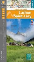
Luchon - Saint-Lary - Haute-Garonne - Hautes Pyrénées 1:30.000 (LS) Wanderkarte Spanien - ALPINA
<< Spanien: Wanderkarten - EDITORIAL ALPINA
<< Frankreich: Pyrenäen
<< Spanien: Pyrenäen
 
Cover

Ausgezeichnete Wanderkarten für Spanien.

Blattschnitte ALPINA

The two maps cover the French territory located north of the Posets-Maladeta Natural Park and, by including the mountain huts on the Spanish side, allow you to plan cross-border hikes through the passes of Benasque, la Glera and la Madera, among others.

The signposted paths in the valleys of Luchon, Oô, Louron and Aure (Saint-Lary) link villages, cross forests, bring us to waterfalls and take us to lakes and summits. Little-known areas such as the Pic d`Arbizon,the Lac de Bareilles, Mont Né and the border area with the Val d`Aran have also been mapped.

Covered area: Departments of the Haute-Garonne and of the Hautes-Pyrénées, Valleys of Luchon, Louron and Aure (Saint-Lary).

Map features: Two topographic maps at a scale of 1:30 000, with information of interest to hikers: mountain huts, marked trails (GR, PR, Local paths), summit ascent routes, access points to hiking areas.

Kartenausschnitt

Kartenbeispiel

Luchon - Saint-Lary - Haute-Garonne - Hautes Pyrénées 1:30.000 (LS) Wanderkarte Spanien - ALPINA
EAN / ISBN: 9788470112072
Preis: EUR 19.90

Bestellartikel: versandfertig in ca. 3-7 Tagen. Dieser Artikel wird speziell für Sie bestellt. Keine Rücknahme!
Produkt EUR Anzahl Bestellen
Luchon - Saint-Lary - Haute-Garonne - Hautes Pyrénées 1:30.000 (LS) Wanderkarte Spanien - ALPINA 19.90
Versandkostenfrei in Deutschland ab 30,- Bestellwert

incl. MwSt.

Stichworte, die bei der Suche nützlich sein könnten:
Pico Perdiguero - Hautes Pyrénées - Saint-Lary-Soulan - Luchon - Bossost - Französische Pyrenäen - Gran Bachimala - Haute-Garonne - Saint-Lary - Alpina-Karten - Wanderkarten Spanien - Spanische Wanderkarten - Editorial Alpina - Alpina Landkarten - Pyrenäen - Pyrenäen Wanderführer - Pyrenäen

Zuletzt angesehene Artikel:

CoverLuchon - Saint-Lary - Haute-Garonne - Hautes Pyrénées 1:30.000 (LS) Wanderkarte Spanien - ALPINA

Cover105G - Finlayson Lake Topographische Landkarte 1:250.000 - Canada - Yukon Territory

Cover5518 Butzbach Topographische Landkarte Hessen 1:25.000 - ProjektNord

CoverCorrèze - 30 plus beaux sentiers à pied Wanderführer - (französisch) Chamina - Frankreich

CoverCarlit - Bollosa 1:30.000 - Alta Cerdanya - Capcir - Arieja (CB) Wanderkarte der Pyrenäen - Spanien - ALPINA

Cover086 N Romsdalen NORD 1:50.000 - Topographische Landkarte Norwegen - ProjektNord - Startens Kartverk

CoverAusseerland - Totes Gebirge - XL Wanderkarte (Nr. 039) KOMPASS

Cover6018 Langen Topographische Landkarte Hessen 1:25.000 - ProjektNord

Cover4925 Sontra Topographische Landkarte Hessen 1:25.000 - ProjektNord

CoverNorwegen (Blatt 3331) - 1:975.000 Landkarte Adventure Map
Norway National Geographic

CoverSpetses / Mini Orange Blue (MOBSP) Regionale Wanderkarte 1:25.000 Orama - Griechenland

CoverGlenfinnan - Moidart & Gulvain XT25 HARVEY MAPS Großbritannien

CoverSamothraki / Mini Orange Blue (MOBST) Regionale Wanderkarte 1:35.000 Orama - Griechenland

CoverMassif du Sancy à pied - Puy de Dôme Wanderführer - (französisch) Chamina - Frankreich

Cover4821 Fritzlar Topographische Landkarte Hessen 1:25.000 - ProjektNord

Cover4522 Hofgeißmar Topographische Landkarte Hessen 1:25.000 - ProjektNord

Cover5819 Hanau Topographische Landkarte Hessen 1:25.000 - ProjektNord

Cover5414 Mengerskirchen Topographische Landkarte Hessen 1:25.000 - ProjektNord

Noch kein Cover vorhanden046 N Romerike NORD 1:50.000 - Topographische Landkarte Norwegen - ProjektNord - Startens Kartverk

CoverOccitanie - 60 plus beaux sentiers à pied Wanderführer - (französisch) Chamina - Frankreich
