 Thematic map "Svetilista / Sanctuaries` is a perfectly designed and conceptually realized publication that by means of images and texts conveys the complete information on all Orthodox, Roman Catholic and Early Christian buildings in Serbia and Montenegro.
On an easy-to-survey map of a pleasant backplane, artistically designed images and names for each of the buildings there are over 100 buildings of this category displayed.
Since the number of buildings far exceeds the number of those that can be presented in this way, there is a detailed list of 264 buildings along with the photos of the most famous ones printed on the back side of the map.
It is particularly important to stress the fact that this list shows buildings clearly classified according to the style and period they belong to. Thus, there are 4 major periods: - 6th - 13th century, Old Christian Basilicas, Pre-Romanic and Romanic styles
- 12th - 16th century, Raska style, Byzantine stylistic group, Morava style Churches and Monasteries, Monasteries and Nunneries in Backa, Srem and Banat from the Middle Ages
- 16th - 18th century, Serbia and Bosnia in the period 16th-18th century, Montenegro and Herzegovina in 16th -18th century, Baroque-style Roman Catholic Churches on the coast
- 18th-20th century, Serbian and Baroque-style Churches in the Danube valley, Log Churches and Serbian Orthodox Churches of the 19th and 20th centuries.
(Kyrillisch) Kartenausschnitt Kartenausschnitt
Kartenbeispiel
|
Sakralbauten in Serbien und Montenegro - Klöster und Kirchen 1:880.000
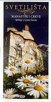
Svetilista (manastiri i crkve SCG) Magic Map Serbien
EAN / ISBN: 9788678020087
Preis: EUR 8.90
|
|


