Willkommen bei MapFox
Wurde Ihre Bestellung bestätigt? Wenn nicht - gab es evtl. ein SERVER-Problem! Bitte kontaktieren Sie uns! +++ Buchhändler-Anfragen erwünscht +++
Warenkorb
Artikel: 0 - € 0.00
Zur Kasse
Widerruf Impressum Kontakt Versandkosten AGB
The High Coast Hiking, Kayaking and Sightseeing in the World Heritage Site, Archipelago and Skuleskogen National Park - Wanderführer englisch Calazo Förlag Schweden
<< Calazo Förlag - Schweden - Finnland - Norwegen - Dänemark
 
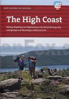
Cover

Fermented herring and the world’s highest coastline

There are countless extraordinary phenomena to be discovered where the land uplift is the fastest in the world. Nowhere else in Sweden can you hike at these heights so close to the sea. You’ll find the country’s most extreme local flora - the northernmost southern plant species and the southernmost northern plant species, sometimes growing on the same mountain.

You’ll find fantastic hikes over mountaintops smoothed by the sea and through the deepest of forests that can offer you complete solitude, if that’s what you’re looking for. You’ll come across culinary challenges such as the pride of the region; fermented Baltic herring. The High Coast in a nutshell.

Contents include: the High Coast Trail, Arnäsleden Trail, best hikes along the World Heritage Trail, a guide to the archipelago’s islands, Skuleskogen National Park, climbing and hiking on Skuleberget, Smitingen and Härnöklubb Nature Reserve, fishing chapels and the best kayaking routes along the coast.

Author Steven Ekholm has written for many years about travelling, food and literature for a number of newspapers and magazines. His itchy feet have taken him as far afield as Patagonia, Svalbard, Lesotho, Transnistria, Mongolia and all the way to Mt Everest. But his first hiking guide is about his home region, the High Coast World Heritage Site.

Titelübersicht im Mapchooser Alle Calazo-Titel

Kartenausschnitt

Kartenbeispiel

The High Coast Hiking, Kayaking and Sightseeing in the World Heritage Site, Archipelago and Skuleskogen National Park - Wanderführer englisch Calazo Förlag Schweden
EAN / ISBN: 9789188779236
Preis: EUR 29.90

Bestellartikel: versandfertig in ca. 2 Wochen oder länger. Dieser Artikel wird speziell für Sie bestellt. Keine Rücknahme!
Produkt EUR Anzahl Bestellen
The High Coast Hiking, Kayaking and Sightseeing in the World Heritage Site, Archipelago and Skuleskogen National Park - Wanderführer englisch Calazo Förlag Schweden 29.90
Versandkostenfrei in Deutschland ab 30,- Bestellwert

incl. MwSt.

Stichworte, die bei der Suche nützlich sein könnten:
The Arnäsleden Trail - Skuleskogen National Park - The Archipelago - Höga Kusten Wanderführer - High Coast - Schweden Wanderführer - Schweden Wanderkarten - Schweden Fjällkarten - Fjällkartan - Schweden Kajakführer - Schweden Gewässerkarten - Schweden Schärengebiete - Schweden Seekarten - Schweden Wasersportkarten - Schweden Paddelführer - Schweden Kanuführer - Schweden Kajakführer - Schweden MTB-Führer - Schweden Mountainbike-Führer - Schweden Kletterführer - Calazo Verlag - Calazo Förlag - Schweden Outdoorführer - Sjökartan - Kustkartan - Finnland Wanderkarten - Finnland Outdoorkarten - Finnland Wassersportkarten - Finnland Kanukarten - Suomi - Finnland Landkarten - Norwegen Fjellkarten - Norwegen Wanderkarten - Norwegen Landkarten - Dänemark Wanderkarten

Zuletzt angesehene Artikel:

CoverThe High Coast Hiking, Kayaking and Sightseeing in the World Heritage Site, Archipelago and Skuleskogen National Park - Wanderführer englisch Calazo Förlag Schweden

Noch kein Cover vorhanden4131 Derenburg Topographische Karte 1:25.000 Landesamt für Vermessung und Geoinformation Sachsen-Anhalt (Landesvermessungsamt)

Cover3450 Müncheberg Sonderausgabe mit Wanderwegen - Topographische Wanderkarte Brandenburg 1:25.000 ProjektNord

Cover3224 Westenholz Amtliche topographische Karte 1:25.000 Landesvermessungsamt Niedersachsen

CoverPantanal Wildlife - Brazils Great Wetland Bradt wildlife guides Bradt Publications

Cover1017 MATALASCAÑAS NORTE Topographische Landkarte 1:50.000 Spanien (Grundlage MTN50) Instituto Geográfico Nacional - CNIG Spanien - ProjektNord

Cover3549 Herzfelde Sonderausgabe mit Wanderwegen - Topographische Wanderkarte Brandenburg 1:25.000 ProjektNord

Cover2222 Glückstadt Amtliche topographische Karte 1:25.000 Landesvermessungsamt Niedersachsen

Noch kein Cover vorhanden2119SB Patay - Ouzouer-le-Marché GPS Amtliche Topographische Wanderkarte Frankreich 1:25.000 - série bleue (IGN)

Cover0200 BURGOS Topographische Landkarte 1:50.000 Spanien (Grundlage MTN50) Instituto Geográfico Nacional - CNIG Spanien - ProjektNord

Cover1257 ST. MORITZ - Silvaplana - Sameden - Pontresina 1:25.000 Topographische Landeskarte der Schweiz - swisstopo

CoverKanu Kompakt Altmühl Gunzenhausen - Dietfurt a. d. Altmühl. Mit topografischen Wasserwanderkarten inkl. Radwanderweg. Text v. Hennemann, Michael - Kettler, Thomas

CoverColline di San Luca - Bologna (Blatt 01 BO) Wanderkarte 1:25.000
Colline di San Luca - Bologna Carta escursionistica 01BO l´Escursionista Editore Italien

Noch kein Cover vorhanden4242 Pretzsch (Elbe) Topographische Karte 1:25.000 Landesamt für Vermessung und Geoinformation Sachsen-Anhalt (Landesvermessungsamt)

Noch kein Cover vorhanden4142 Elster (Elbe) Topographische Karte 1:25.000 Landesamt für Vermessung und Geoinformation Sachsen-Anhalt (Landesvermessungsamt)

Noch kein Cover vorhanden2228SB Aigurande - Châtelus-Malvaleix GPS Amtliche Topographische Wanderkarte Frankreich 1:25.000 - série bleue (IGN)

Noch kein Cover vorhanden6 II c - Topographische Landkarte Portugal 1:50.000 Carta Militar de Portugal Instituto Geográfico do Exército (IGeoE) - Portugal

CoverSkien Ost Wanderkarte Norwegen 1:25.000 (Blatt 2527)
Skien Øst - Nordeca / UGLAND / Statens Kartverk Norwegen

CoverNM 33-10-23 (3323) Ried im Innkreis Österreichische Karte 1:50.000 mit Wegmarkierungen (topographische Wanderkarte - UTM) - BEV - Österreich

CoverL6712 Annweiler am Trifels (TK50) Amtliche topographische Landkarte 1:50.000 - Landesamt für Vermessung und Geobasisinformation Rheinland-Pfalz