| << Calazo Förlag - Schweden - Finnland - Norwegen - Dänemark |
  | |
|
||
Zuletzt angesehene Artikel:
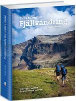
![]() | Bergwandern - Wanderführer schwedisch Stora boken om fjällvandring Calazo Förlag Schweden |
![]() | Turda, Jerischmarkt und Thorenburger Schlucht Stadtplan Torda, Aranyosgyéres és a Tordai hasadék térképe / Turda, Ghiris-Aries, Cheile Turzii Rumänien - Hiszi-Map |
![]() | 350.43 Osinow Dolna Amtliche topographische Karte 1:25.000 Polen |
![]() | Libye 100 itinéraires GPS dans le désert Guide J. Gandini - Serre Editeur |
![]() | 3046-SW Topographische Karte 1:10.000 - Landesvermessungsamt Brandenburg |
![]() | MONTSENY - 60 excursions - 100 indrets imprescindibles Wanderkarte 1:30.000 - Editorial Piolet - Spanien |
![]() | Tunesien Pflanzen - Tiere - Strände - Regionen - Nationalparks - Karten. Naturreiseführer - von Mike Liebscher - Natur und Tier |
![]() | 325.34 Amtliche topographische Karte 1:25.000 Polen |
![]() | 365.43 Amtliche topographische Karte 1:25.000 Polen |
![]() | L5322 Lauterbach (geplottete Ausgabe) Topographische Landkarte Hessen 1:50.000 - ProjektNord |
![]() | Naturpark Sierra de Grazalema - Topographische Wanderkarte 1:40:000 Sierra de Grazalema - Natural Park - hiking map / Parque natural - mapa senderismo Editorial Penibética - Spanien |
![]() | 345.42 Amtliche topographische Karte 1:25.000 Polen |
![]() | P3324 Laihia Topographische Karte 1:25.000 EUREF (Peruskartta) Maanmittauslaitos / Lantmäteriverket Finnland - ProjektNord |
![]() | Masurische Seenplatte - 2 Segelkarten - Polen 1:60.000 Jeziora Mazurskie - ExpressMap |
![]() | L5908 Cochem (TK50) Amtliche topographische Landkarte 1:50.000 - Landesamt für Vermessung und Geobasisinformation Rheinland-Pfalz |
![]() | Sylt - Amrum - Föhr Die schönsten Wanderungen in Nordfriesland. 50 Touren. GPS - von Bernhard Pollmann - Bergverlag Rother |
![]() | Amsterdam City Guide Reiseführer Lonely Planet (engl.) |
![]() | BERGUEDÀ - Parapente 1:50.000 Wanderkarte mit Wanderführer Spanien / Katalonien (mehrsprachig) - Editorial Alpina BERGUEDÀ - Parapente Mapa Excursionista |
![]() | Kurz & gut! Allgäu mit Kleinwalsertal und Tannheimer Tal. 43 Touren. Mit GPS-Tracks - Rother Wanderbuch von Gerald Schwabe - Bergverlag Rother |


