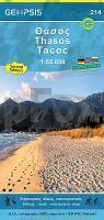
| << GEOPSIS / GeoLab - Griechische Wanderkarten und Straßenkarten << Thasos |
  | |
|
||
Zuletzt angesehene Artikel:
![]() | Thasos (Blatt 214) Ökotouristische Landkarte 1:55.000 (wasserfest) GPS Θάσος Geopsis - Griechenland |
![]() | Kitzbüheler Alpen mit Tuxer und Zillertaler Alpen - Rother Skiführer - Bergverlag Rother |
![]() | 7312/13 Rheinau Topographische Landkarte 1:25.000 - Landesvermessungsamt Baden-Württemberg |
![]() | 082 Basso Garda - Sirmione - Desenzano - Peschiera Topographische Wanderkarte 1:25.000 Casa Editrice Tabacco - Italien |
![]() | 40B ARNHEM Topographische Karte der Niederlande 1:25.000 (Plotausgabe) 40B ARNHEM Topografische Kaart van Nederland Kadaster - ProjektNord |
![]() | Sewastopol (Krim) Stadtplan 1:20.000 (kyrillische Ausgabe) Sevastopol` plan goroda Kartografija - ukrmap Ukraine |
![]() | Sumy Mini-Stadtplan-Atlas 1:16.000 Sumy Kartographia ukrmap (Ukraine) |
![]() | 3025SB Chalon-sur-Saône (Nord) - Chagny GPS Amtliche Topographische Wanderkarte Frankreich 1:25.000 - série bleue (IGN) |
![]() | 13 Exmoor Wanderkarte 1:25.000 Großbritannien AA Automobile Association / OS Ordnance Survey Großbritannien |
![]() | 200 Newquay & Bodmin - Camelford & St Austell - Wanderkarte Großbritannien 1:50.000 LANDRANGER MAP - Ordnance Survey |
![]() | 7622 Hohenstein Topographische Landkarte 1:25.000 - Landesvermessungsamt Baden-Württemberg |
![]() | 11 VALENCIA - COSTA BLANCA SUR 1:150.000 Touristische Landkarte Spanien - Geo / Estel |
![]() | 124 N Namdalen NORD 1:50.000 - Amtliche Topographische Landkarte Norwegen - Startens Kartverk |
![]() | Südafrika (Blatt 748) Lesotho - Eswatini - Straßen- und Tourismuskarte 1:1.4 Mio. South Africa Michelin |
![]() | Skipbåtsvær - Træna - Seekarte Norwegische Küste 1:50.000 - (Blatt 58) Den Norske Kyst Sjøkart - Hovedkart (sjø) Statens Kartverk Sjø - Norwegen |
![]() | 8317/8417 Jestetten Topographische Landkarte 1:25.000 - Landesvermessungsamt Baden-Württemberg |
![]() | 12 Napfbergland MTB-Karte 1:50.000 - Swiss Singletrail Map |
![]() | Hamburg Poster 70 x 100 cm - von Nina Simone Wilsmann - Vianina |
![]() | Norwegen 4 - Zentral- und Nord-Norwegen Auto- und Touristenkarte 1:415.000 - Norstedts Mellersta och norra Norge - EasyMap |
![]() | 1620SB la Flèche.Sablé-sur-Sarthe GPS Amtliche Topographische Wanderkarte Frankreich 1:25.000 - série bleue (IGN) |


