| << Russland |
||
|
||
Zuletzt angesehene Artikel:
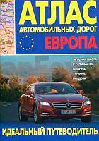
 | Europa - Westeuropa - Baltische Staaten - WeiÃrussland - Ukraine - Moldau Autoatlas / StraÃenatlas - Russland Atlas awtomobilnych dorog. Ewropa. Sapadnaja Ewropa, strany Baltii, Belarus, Ukraina, Moldowa |
 | 0893-2 EL ALTET Topographische Landkarte 1:25.000 Spanien (Grundlage MTN25) Instituto Geográfico Nacional - CNIG Spanien - ProjektNord |
 | 4507 Mülheim an der Ruhr - Wanderkarte mit Wanderwegen (geplottete Ausgabe) ProjektNord - Grundlage Amtliche topographische Karte 1:25.000 Landesvermessungsamt Nordrhein-Westfalen |
 | G10 Lauf an der Pegnitz - Altdorf b.Nürnberg, Leinburg, Heroldsberg, Winkelhaid, Feucht, Röthenbach a.d.Pegnitz ATK25 Topographische Karte 1:25.000 (Atkis) Bayern Landesvermessungsamt Bayern - Wanderkarte - Radwanderkarte |
 | NL 32-06-01 Ost (2101-Ost) Galtür Ãsterreichische Karte 1:25.000 mit Wegmarkierungen (topographische Wanderkarte - UTM) - BEV - Ãsterreich - VergröÃerung (ÃK25V) |
 | 1216 Borgsum (Föhr) - Gestern und Heute - Historische Ãberlagerung 1878-1880 Topographische Landkarte 1:25.000 im Vergleich - Landesvermessungsamt Schleswig-Holstein / ProjektNord |
 | Heilbronn Rad- und Wanderkarte mit Ausflugszielen, Einkehr- & Freizeittipps, StraÃennamen, wetterfest, reiÃfest, abwischbar, GPS-genau. 1:50000 - von - Freytag-Berndt und ARTARIA PUBLICPRESS |
 | 4 Naturpark Bergisches Land - Mitte: Bergisch Gladbach - Engelskirchen - Lindlar - Lohmar - Nürnbrecht - Overath - Rösrath - Wiehl Wanderkarte im Naturpark Bergisches Land 1:25.000 Naturarena / Naturpark Bergisches Land |
 | Südwest-Karelien - Ladoga Nord Touristenkarten 1:240.000 Юго-Западная Карелия Diskus Media S.Petersburg |