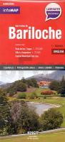
| << Argentinien << Ningit - InfoMap |
  | |
Zuletzt angesehene Artikel:
![]() | San Carlos de Bariloche - Regionalkarte 1:160.000 Laminierte Straßenkarte - infoMAP NINGIT Argentinien NINGIT Argentinien |
![]() | SOMME - AMIENS - ABBEVILLE - PNR BAIE DE SOMME PICARDIE MARITIME (Blatt D80) Département-Landkarte Frankreich 1:100.000 SOMME - Carte départementale - IGN Frankreich |
![]() | 13-424 Topographische Karte 1:25.000 der Tschechischen Republik Zakladní mapa Ceská republika Cesky urad zememericky a katastralni - ProjektNord |
![]() | Namur - Tours à vélo - De la Belgique à la Loire Radwanderanderführer für den EuroVelo 3 mit Varianten - (französisch) Chamina - Frankreich |
![]() | 0437 ATECA Topographische Landkarte 1:50.000 Spanien (Grundlage MTN50) Instituto Geográfico Nacional - CNIG Spanien - ProjektNord |
![]() | 0776 MONTIJO Topographische Landkarte 1:50.000 Spanien (Grundlage MTN50) Instituto Geográfico Nacional - CNIG Spanien - ProjektNord |
![]() | M4211 Nokia Topographische Karte 1:25.000 EUREF (Peruskartta) Maanmittauslaitos / Lantmäteriverket Finnland - ProjektNord |
![]() | 0715-3 LAS MESAS Topographische Landkarte 1:25.000 Spanien (Grundlage MTN25) Instituto Geográfico Nacional - CNIG Spanien - ProjektNord |
![]() | 0732 VALDECABALLEROS Topographische Landkarte 1:50.000 Spanien (Grundlage MTN50) Instituto Geográfico Nacional - CNIG Spanien - ProjektNord |
![]() | 24-142 Topographische Karte 1:25.000 der Tschechischen Republik Zakladní mapa Ceská republika Cesky urad zememericky a katastralni - ProjektNord |
![]() | L6338 Weiden i. d. Oberpfalz (geplottete Ausgabe) Topographische Karte Bayern 1:50.000 Bayerisches Landesvermessungsamt |
![]() | 1022 CAMPILLOS Topographische Landkarte 1:50.000 Spanien (Grundlage MTN50) Instituto Geográfico Nacional - CNIG Spanien - ProjektNord |
![]() | Neuss Topographische Wanderkarte Nordrhein-Westfalen mit Wanderwegen und Radwegen 1:25.000 - ProjektNord |


