Willkommen bei MapFox
Wurde Ihre Bestellung bestätigt? Wenn nicht - gab es evtl. ein SERVER-Problem! Bitte kontaktieren Sie uns! +++ Buchhändler-Anfragen erwünscht +++
Warenkorb
Artikel: 0 - € 0.00
Zur Kasse
Impressum Kontakt Versandkosten AGB
Sintra Bouldering - Guide Book by Ricardo S. Alves - Kletterführer englisch Ricardo S. Alves
<< Portugal: Reiseführer, Wanderführer und Radwanderführer
 
Cover

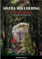
"The Sintra mountain range, part of the Sintra-Cascais Natural Park and classified as a UNESCO World Heritage Site, is a granitic massif that stretches across 10 kilometers, hosting an exuberant forest and a unique historical heritage. The quality of the rock and the undeniable scenic value associated with this protected area has, for more than two decades, exerted a great attraction upon local climbers and beyond borders. This 2021 edition of Sintra Bouldering guide appears for the first time in the form of a book and provides, in a comprehensive and detailed fashion, all necessary information to discover the 1200 boulder problems scattered throughout the forest. It covers 11 climbing zones with unique rock characteristics and climatic conditions, allowing one to climb all year round. Packed with sector location maps, topos, images of all the boulders and spectacular photographs.

Sintra Bouldering - Guide Book by Ricardo S. Alves - Kletterführer englisch Ricardo S. Alves
EAN / ISBN: 9789893317761
Preis: EUR 49.90

Bestellartikel: versandfertig in ca. 2 Wochen oder länger. Dieser Artikel wird speziell für Sie bestellt. Keine Rücknahme!
Produkt EUR Anzahl Bestellen
Sintra Bouldering - Guide Book by Ricardo S. Alves - Kletterführer englisch Ricardo S. Alves 49.90
Versandkostenfrei in Deutschland

incl. MwSt.

Stichworte, die bei der Suche nützlich sein könnten:
Sintra-Cascais Natural Park Kletterführer - Portugal Kletterführer - Portugal - Portugal Reiseführer - Portugal Wanderführer - Portugal Fahrradführer - Portugal Radführer - Portugal Radwanderführer - Portugal MTB-Führer - Portugal Mountainbike

Zuletzt angesehene Artikel:

CoverSintra Bouldering - Guide Book by Ricardo S. Alves - Kletterführer englisch Ricardo S. Alves

CoverFriesland, Ammerland, Wesermarsch, Oldenburg Radkarte mit Ausflugszielen, Einkehr- & Freizeittipps, wetterfest, reissfest, abwischbar, GPS-genau. 1:100000 - von - Freytag-Berndt und ARTARIA Publicpress

Noch kein Cover vorhanden096 N Sunndalsøra NORD 1:50.000 - Amtliche Topographische Landkarte Norwegen - Startens Kartverk

CoverSehenswertes im Allgäu und Oberbayern Reiseführer - Vom Bodensee zum Königsee - von Achim Walder u. Ingrid Walder - Walder-Verlag

CoverNepal Landkarte (Blatt 3000) AdventureMap wasserfest National Geographic

Noch kein Cover vorhanden343.11 Amtliche topographische Karte 1:25.000 Polen

CoverAlvdal Vestfjell - Folldal - Alvdal - Tron- Atnsjøen - Straumbu Topographische Wanderkarte Topo 3000 - 1:50.000 (Blatt 3015) - Nordeca - Norwegen

CoverDNT - Planungskarte Süd-Norwegen 1:500.000 - planleggninskart - Calazo Förlag - Norwegen
DNT planleggninskart Sør-Norge

CoverAsien politisch Laminierte PLANO-Karte 1:13.81 Mio. (Format: 85 x 97 cm) - gerollt im Plastikrohr
Asia political flat map - laminated National Geographic

Cover33-121 Topographische Karte 1:25.000 der Tschechischen Republik
Zakladní mapa Ceská republika Cesky urad zememericky a katastralni - ProjektNord

Cover5282 Attersee - Mondsee - Wolfgangsee 1:35.000 - Wanderkarte / Radwanderkarte / Wintersportkarte Österreich - GPS - Freytag & Berndt

CoverAçores Folha 29 - Ilha de São Miguel - Maia mit Wanderwegen - Wanderkarte 1:25.000 Portugal - ProjektNord

CoverAbruzzen - Molise 1:200.000 - Straßenkarte Italien
Abruzzo - Molise Libreria Geografica - Italien

CoverAustfirdir (Blatt 14) Wanderkarte Island 1:100.000 / 1:50.000 - Sérkort - Mál og menning

CoverTrekking the Annapurna Circuit Trekking Guide by Andrees de Ruiter & Prem Rai - Himalayan MapHouse - Nepal

CoverFolyMap Touring-Atlas Französische Alpen 1:250.000 (spiral) Touristik-Verlag Vellmar

CoverAchterhoek fietsstuurkaart Fahrradkarte Niederlande Buijten & Schipperheijn

Noch kein Cover vorhandenAtlanta, Greater - City Map Stadtplan USA Rand McNally

CoverADAC LänderKarte Deutschland 1:650.000

CoverADFC-Radtourenkarte KRO-IS Istrien Kvarner Bucht - mit Tagestourenvorschlägen - 1:100.000 - reiß- und wetterfest - E-Bike geeignet - GPS-Tracks Download Von Triest bis Pula, von Porec bis Krk. Mit Parenzana Radweg - BVA BikeMedia