Willkommen bei MapFox
Wurde Ihre Bestellung bestätigt? Wenn nicht - gab es evtl. ein SERVER-Problem! Bitte kontaktieren Sie uns! +++ Buchhändler-Anfragen erwünscht +++
Warenkorb
Artikel: 0 - € 0.00
Zur Kasse
Impressum Kontakt Versandkosten AGB
NE513 Dolpo Circuit 1:125.000 - Dolpo Region
<< Nepal
<< Himalayan Map House
 
Cover

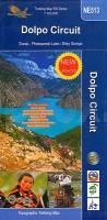
The Upper and Lower Dolpo Circuits in western Nepal presented on a map at 1:125,000 from Nepa Maps with coverage extending from the Shey Phoksundo National Park to Jumla. The two Dolpo Circuits, the Kagmara La trek and the Jumla to Juphal route are prominently highlighted. The map also indicates which sections of the marked routes are part of the Upper or the Lower Great Himalayan Trail (GHT). Contour lines are at 80m intervals. Latitude and longitude are shown by margin ticks at 5` intervals. The index list places, peaks, base camps and lakes. On the inside cover are stage-by-stage distances and timings for the main trekking routes.

Kartenausschnitt

Kartenbeispiel

NE513 Dolpo Circuit 1:125.000 - Dolpo Region
EAN / ISBN: 9789937918749
Preis: EUR 21.90

sofort versandfertig Dieser Artikel ist im Normalfall sofort lieferbar.
Produkt EUR Anzahl Bestellen
NE513 Dolpo Circuit 1:125.000 - Dolpo Region 21.90
Versandkostenfrei in Deutschland ab 30,- Bestellwert

incl. MwSt.

Stichworte, die bei der Suche nützlich sein könnten:
Phoksumdo Lake - Dolpo Circuit - Shey Gompa - Dunai - Nepal - Nepal Landkarten - Nepal Reiseführer - Nepal Atlanten - Nepal Kartographie - Nepal Fahrradkarten - Nepal Radwanderkarten - Nepal Karten - Nepalkarten - Nepal Kartografie - Nepal Wanderkarten - Nepal Landkartenverkauf - Nepal Radwanderführer - Nepal Straßenkarten - Himalayan Map House - Nepal - Himalaya Trekkingkarten - Nepal Landkarten

Zuletzt angesehene Artikel:

CoverNE513 Dolpo Circuit 1:125.000 - Dolpo Region

CoverCusco (Peru) Tourist Map EDITORIAL LIMA 2000 S.A.

Cover5 Luchon - Comminges - Louron carte de randonnées 1:50.000 (Pyrénées carte no. 5) - Pyrenäen-Wanderkarte RANDO EDITIONS

Cover0678-1 SANTIAGO DEL CAMPO Topographische Landkarte 1:25.000 Spanien (Grundlage MTN25) Instituto Geográfico Nacional - CNIG Spanien - ProjektNord

CoverPrag 1:17.500 - laminierter Stadtplan comfort!map
Prague ExpressMap

CoverFrankreich Départements - puzzle magnets (französisch) 100 Teile - City Puzzle Extragoods

Cover0157-1 SEOANE DO COUREL Topographische Landkarte 1:25.000 Spanien (Grundlage MTN25) Instituto Geográfico Nacional - CNIG Spanien - ProjektNord

CoverErmionida - Trizinia / Poros - Hydra - Spetses (wasserfest und reißfest) Regionale Wanderkarte STEP BY STEP 1:75.000
ΕΡΜΙΟΝΙΔΑ - ΤΡΟΙΖΗΝΙΑ - ΠΟΡΟΣ - ΥΔΡΑ - ΣΠΕΤΣΕΣ Orama - Griechenland

Cover588 Salir (Loulé) Topographische Landkarte Portugal 1:25.000 Carta Militar de Portugal - Série M888 Instituto Geográfico do Exército (IGeoE) - Portugal

CoverPirinieo aragonés: Valles Occidentales - Ansó - Echo - Wanderkarte 1:25.000 Prames - Spanien

CoverPembrokeshire Coast Path - Wales Coast Path: St Dogmaels to Amroth - Brian John - Aurum Press Ltd

CoverChiemsee, Wander-, Rad- und Freizeitkarte 1:50.000, freytag & berndt, WKD 5203, mit Infoguide Simssee - Marquartstein - Traunstein, mit Infoguide, GPX Tracks, wasserfest und reißfest - von freytag & berndt - Freytag-Berndt und ARTARIA

CoverProvinz La Spezia + 5 Terre (Blatt SV-20/SP-20) Topographische Straßenkarte und Touristenkarte 1:100.000 mit Radwegen
Provincia di La Spezia e 5 Terre - Carta stradale e turistica con piste ciclabili EdM Edizioni del Magistero - Italien

CoverNiederlitauen (Schemaitien, Samogitien) Touristische Landkarte 1:250.000
Zemaitija Jana Seta

Cover0923 CÓRDOBA Topographische Landkarte 1:50.000 Spanien (Grundlage MTN50) Instituto Geográfico Nacional - CNIG Spanien - ProjektNord

Cover273 - Topographische Landkarte Portugal 1:25.000 Carta Militar de Portugal - Série M888 Instituto Geográfico do Exército (IGeoE) - Portugal

CoverFläming 1:75.000 (Blatt RK-BRA07) Bikeline Radkarte Deutschland - Esterbauer

CoverZagorje West (Blatt 2) Topographische Wanderkarte 1:25.000 / 1:10.000 - Serie Kroatien kontinental
Zapadno Zagorje - Serija Kontinentalna Hrvatska - Mountaineering and Hiking map - Croatian Mountain Rescue Service Kroatischer Bergrettungsdienst - Kroatien

CoverMartinique & Guadeloupe Travel Reference Map 1:65.000 / 100.000 (engl.)
Martinique & Guadeloupe ITMB International Travel Maps (engl.)

Cover35/5-6 Plombieres - Grünental NGI 1:25.000 Topographische Landkarte Belgien