| << Berlin und Brandenburg: Topographische Karte 1:10.000 - Landesvermessung und Geobasisinformation Brandenburg und ProjektNord |
  | |
Zuletzt angesehene Artikel:
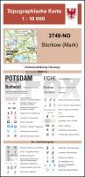
![]() | 3749-NO Storkow (Mark) Topographische Karte 1:10.000 - Landesvermessungsamt Brandenburg |
![]() | Rund um Betzdorf Topographische Wanderkarte Rheinland-Pfalz mit Wanderwegen und Radwegen 1:25.000 - ProjektNord |
![]() | 16/5-6 LIER - NIJLEN NGI 1:25.000 Topographische Landkarte Belgien |
![]() | Savoie - 20 plus beaux lacs à pied Wanderführer - (französisch) Chamina - Frankreich |
![]() | 10017 Bykle Topographische Landkarte 1:50.000 Norge-serien - Nordeca Norwegen |
![]() | Alsace - Les 30 plus beaux balades à pied Wanderführer - (französisch) Chamina - Frankreich |
![]() | BX17 Topographische Landkarte Neuseeland 1:50.000 Land Information New Zealand |
![]() | 3954 Wellmitz Topographische Karte 1:25.000 Landesvermessungsamt Brandenburg (gefaltet) |
![]() | 09 Skagi Atlaskort - Topographische Landkarte Island 1:100.000 Skagi Forlagid - Mál og menning - Island |
![]() | Parchi e Quartieri di Roma dentro il GRA 1:30.000 (Blatt 1) Topographische Wanderkarte Edizioni Il Lupo |
![]() | Nepal Menschen und Landschaften am Great Himalaya Trail - von Dieter Höss - Tyrolia-Verlag |
![]() | Annapurna Treks - Annapurna-Runde - Annapurna Base Camp - Nar Phu - Tilicho Lake - Poon Hill - Wanderführer - Bergverlag Rother |
![]() | Südheide - Gifhorn 1:60.000 bikeline-Radwanderkarte Deutschland Esterbauer |
![]() | BV22 Topographische Landkarte Neuseeland 1:50.000 Land Information New Zealand |
![]() | 6616 Speyer Topographische Karte 1:25.000 - Landesamt für Vermessung und Geobasisinformation Rheinland-Pfalz |
![]() | 438 Dornoch & Tain - Wanderkarte Großbritannien 1:25.000 EXPLORER MAP - Ordnance Survey |
![]() | CC 2326 Lübeck Geologische Übersichtskarte 1:200.000 - Bundesanstalt für Geowissenschaften und Rohstoffe (BGR) |
![]() | Niederrheinroute Radwanderatlas Spiralo 1:75.000 BVA Bielefelder Verlag |
![]() | Meine Wanderkarte Sachsen Topographische Wanderkarte mit Wanderwegen 1:25.000 - ProjektNord |
![]() | Rhodos - Chalki - Symi aus der Vogelperspektive Bildband Rhodos - Chalki - Symi - As the seagull flies - Anavasi - Griechenland |


